Latest in Landsat October 2024 - Vol. 3 | Issue 10
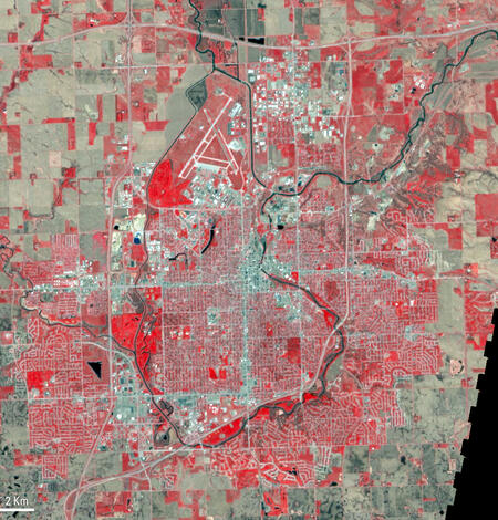
Mission celebrations for Landsat 7 and Landsat 9! Two podcasts released recently teach us more about bathymetry mapping and how MTBS data are helpful when mapping smaller-than-usual fires in Utah. What popular U.S. city grew up alongside Landsat 7? We'll also introduce you to a new tool available within the USGS EROS Archive.
Landsat 7 Rests After 25 years of Service
Historic mission propelled land-change science into to the new millennium
2024 marks the 25th anniversary of Landsat 7's place in space. It also marks the year of the long-time satellite's end of mission celebration. Landsat 7 had the distinct pleasure of ushering in the 21st century for the USGS Landsat Missions Program. We begin this issue by celebrating the accomplishments of this historic mission.
Check out the stories and images below to see how Landsat 7 left its mark on land-change science around the world.
End of an era: Historic Landsat 7 mission takes final images
RESTON, Va. — After more than 132,000 trips around the Earth and more than 3.3 million satellite images under its belt, the work of the Landsat 7 satellite is complete, even as the Landsat science mission continues with newer satellites.
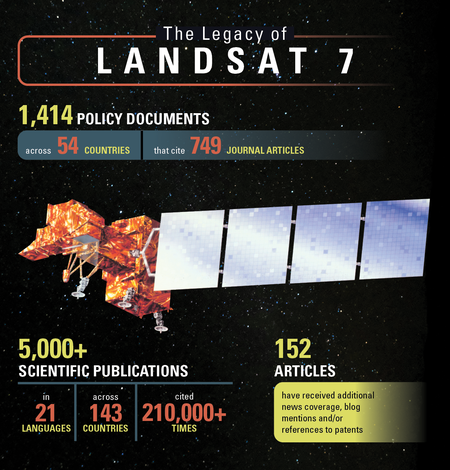
The Legacy of Landsat 7 — Citations in Policy & Publications
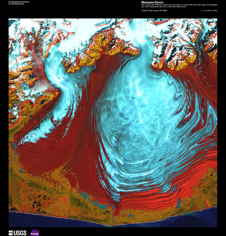
For 25 years, the Landsat 7 satellite acquired millions of images of Earth that supported studies of how land is used and how it has changed across urban, agriculture, forest, snow and ice-covered areas around the globe, as well as natural and manmade disasters. As the mission comes to a close, we look back at the magnitude and impact that Landsat 7 imagery brought to scientists and those…
Landsat 7 Ushered in a New Era for Land-Change Science
The Landsat 7 mission was pivotal in meeting the need of global Earth observations and propelled land-change science research into a new era. The technology of the mission greatly expanded the capabilities for future Earth observing data application advancements. For 25 years, Landsat 7 captured imagery to help advance Earth land studies. We celebrate the accomplishments of this historic mission.
Landsat 7 Views of Las Vegas
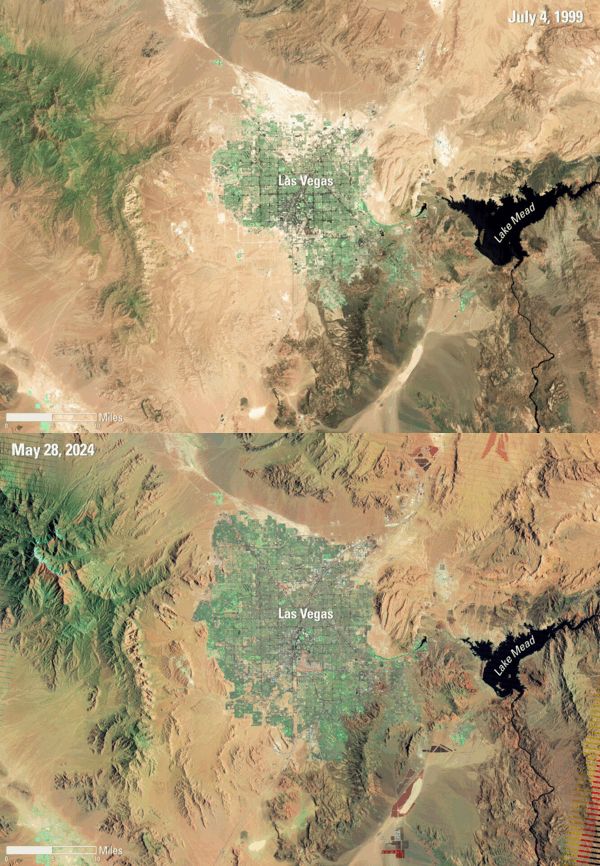
Las Vegas, Nevada and the area surrounding it has been and remains a popular region of interest when showcasing urban growth and land change using Landsat sensors.
It's very easy to see the major urban growth of the city, as well as the changes to the desert areas surrounding it in this animation of Landsat 7 images from 1999 and 2024. The drastic change to the water supply in Lake Mead is eye-catching as well.
Check out these published Earthshots to see more change in this area over the years:
New Application Informs Users About Reprocessed Landsat Products
Query and view a list of Landsat products that have been removed, along with products that have been reprocessed and added back into the inventory
Eyes on Earth Episode 123 – Bathymetry Mapping
This Eyes on Earth episode is the third in our series on using Landsat for coastal studies. We talk to physical geographer Jeff Danielson about bathymetry and how it is critical for coastal modeling. Bathymetry captures the shape of underwater topography, and satellite-derived bathymetry helps fill in areas where there are data gaps. Even though Landsat was designed to image land, it’s a big part…
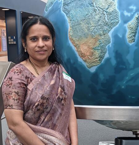
Indian Scientist Exchanges Ideas, Makes Connections at EROS
Radhika Tirumala will return to India reinvigorated by new ideas and new professional friendships forged during her visit to the USGS Earth Resources Observation and Science (EROS) Center.
Eyes on Earth Episode 124 – Mapping Fires in Utah
In this episode of Eyes on Earth, we talk to forest ecologist Jim Lutz about the effort to map fires in Utah. Fire research in the West is dominated by the study of large fires, but the forests in Utah are different. Utah typically does not have a lot of large fires as other western states do. So to better understand the differences that the specific Utah vegetation types have in their response…
Landsat 9 Celebrates Three Years in Space!
Satellite launched September 27, 2021
Looking for Information about Landsat Products? Check out these pages.
-
Landsat Science Products Landsat Science Products
The USGS has developed research-quality, applications-ready Level-2 and Level-3 science products, as well as Analysis Ready Data (ARD) that can be used to monitor, assess, and project how changes in land use, land cover, and land condition affect people and nature.
-
Landsat Data Access Landsat Data Access
In 2008, the Landsat products stored in the USGS EROS archive became available for download at no cost to users. The applications described below allow access to the Landsat products from the USGS archive. Each application provides unique capabilities that may be useful to user preferences, as either single file or large quantity (bulk) downloads.
Do you have questions about Landsat?
-
Connect Connect
Access the information on this page to learn more about Landsat, access our social media platforms, or contact us with questions you have about the Landsat missions, the available science products, and how to access Landsat data!


