U.S. flag

An official website of the United States government

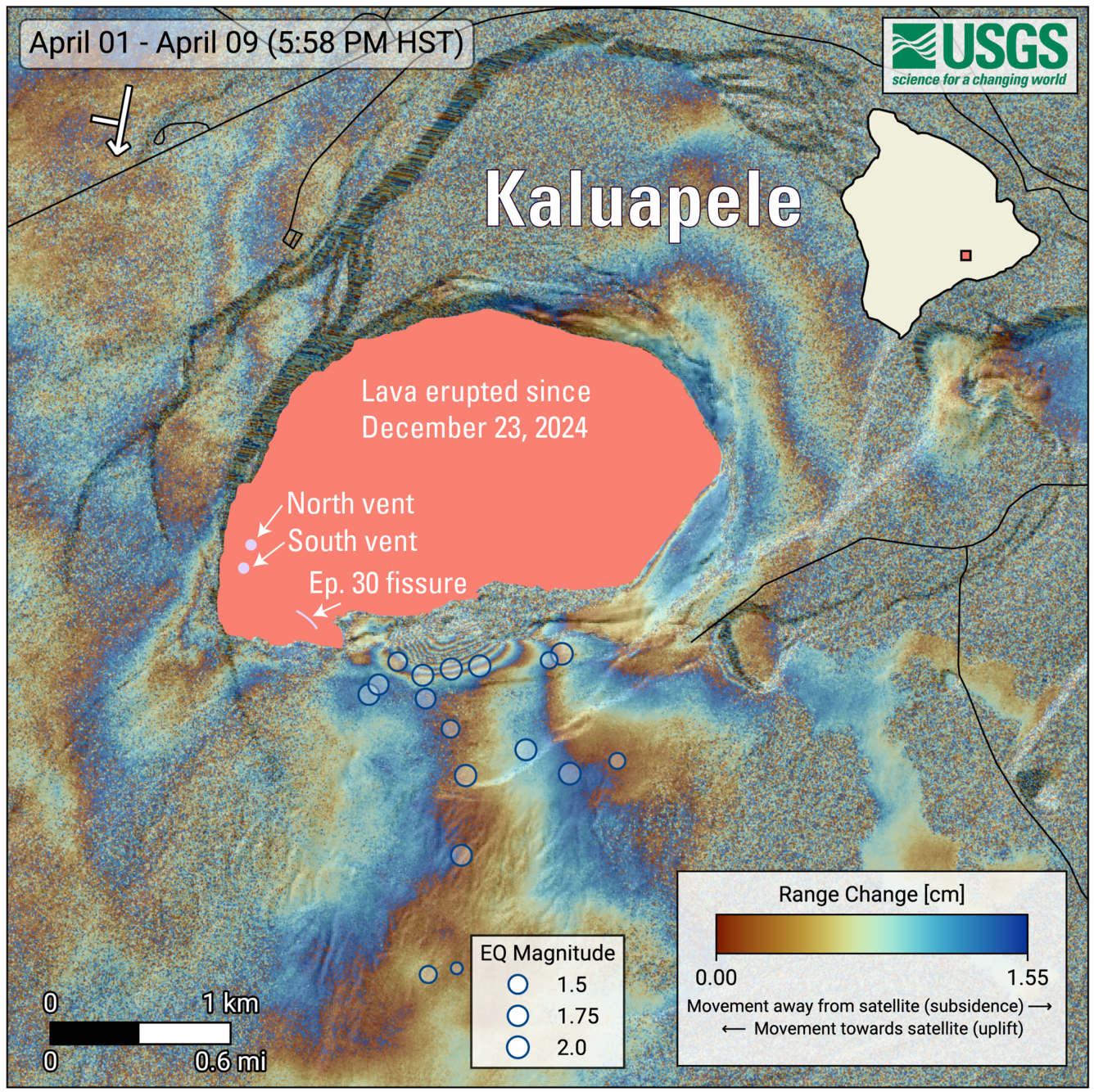
April 15, 2026—InSAR image of Kīlauea deformation associated with episode 44 of ongoing summit eruption

April 15, 2026
Media
Color map graphic showing earthquakes and ground deformation at summit of volcano
COSMO-SkyMed Second Generation (CSG) interferogram for the period from April 1 to April 9, 2026, covering Kīlauea volcano’s summit region. Each color fringe represents 1.55 centimeters (0.61 inches) of ground movement in the direction between the satellite and the ground (range change). The symbol in the upper left indicates the satellite's orbit direction (arrow) and look direction (bar). Earthquakes are marked with circles with the size proportional to their magnitude. The lava flows covering the crater floor are represented by the pink polygon, the two vents (circles) and the Episode 30 fissure (line) are marked in light pink. 
Was this page helpful?