
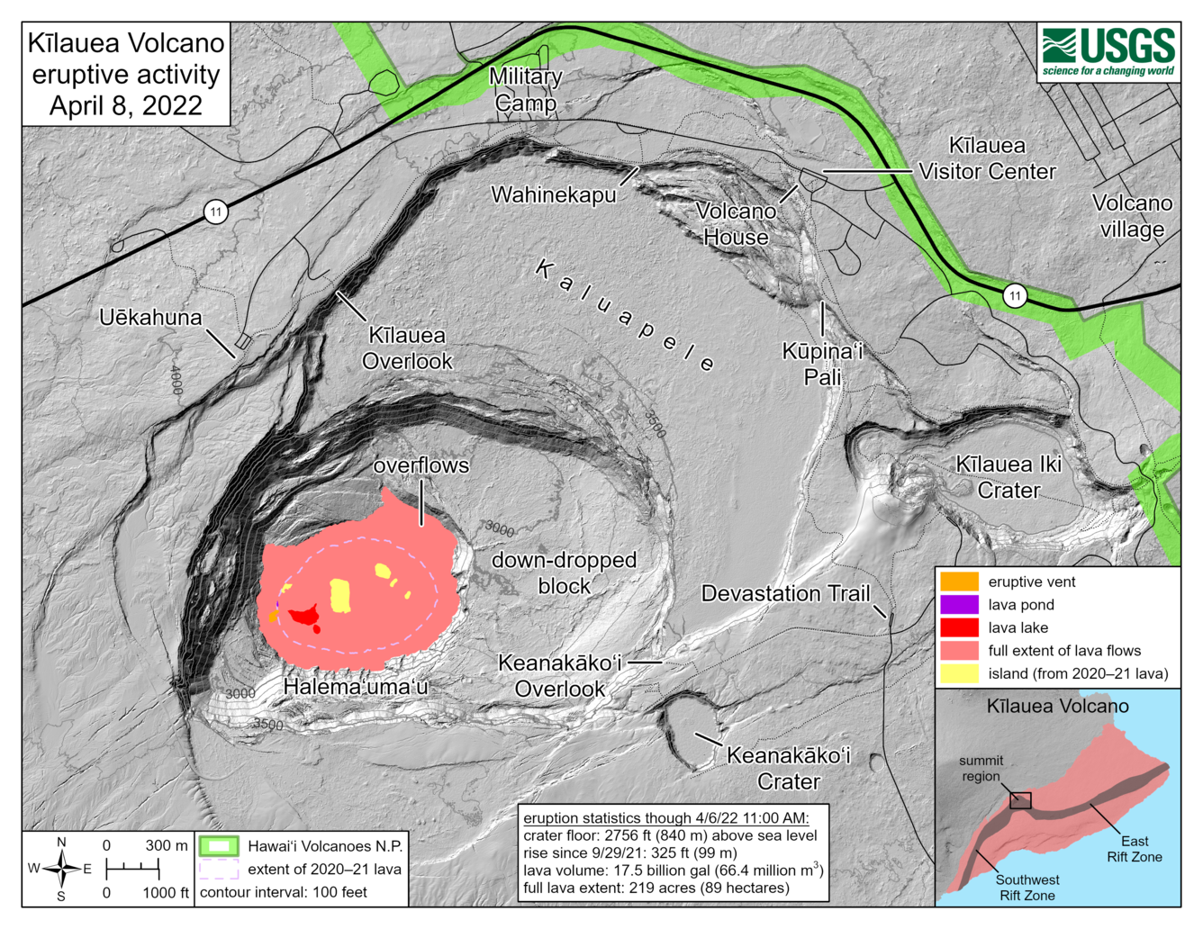
April 8, 2022—Kīlauea summit eruption reference map
April 8, 2022
Media
Sources/Usage: Public Domain. View Media Details