
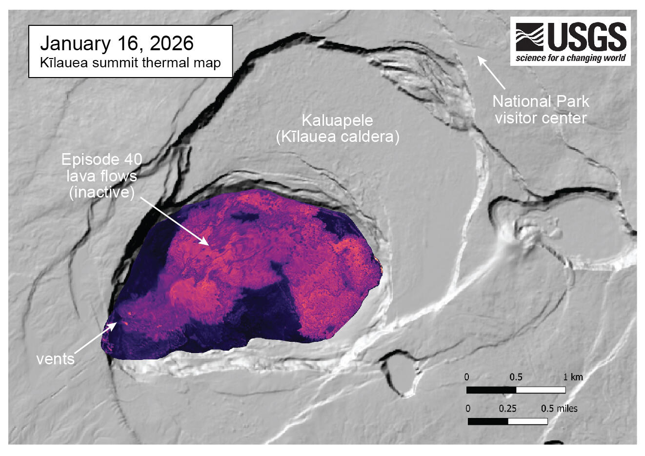
January 16, 2026 — Thermal map of Kīlauea summit after episode 40 lava fountaining
January 16, 2026
Media
Sources/Usage: Public Domain. View Media Details
This thermal map of the summit of Kīlauea was made from images collected during a January 16 overflight, just four days after the episode 40 lava fountaining on January 12. The episode 40 lava flows from the north vent crossed much of crater floor along the north side of the crater. A small ooze-out of lava from the flow was visible (in yellow) at the far eastern end of the new flow. Warmer colors (yellow, red) show higher temperature areas than cooler colors (purple, blue).