
June 25, 2026—Kīlauea summit eruption reference map
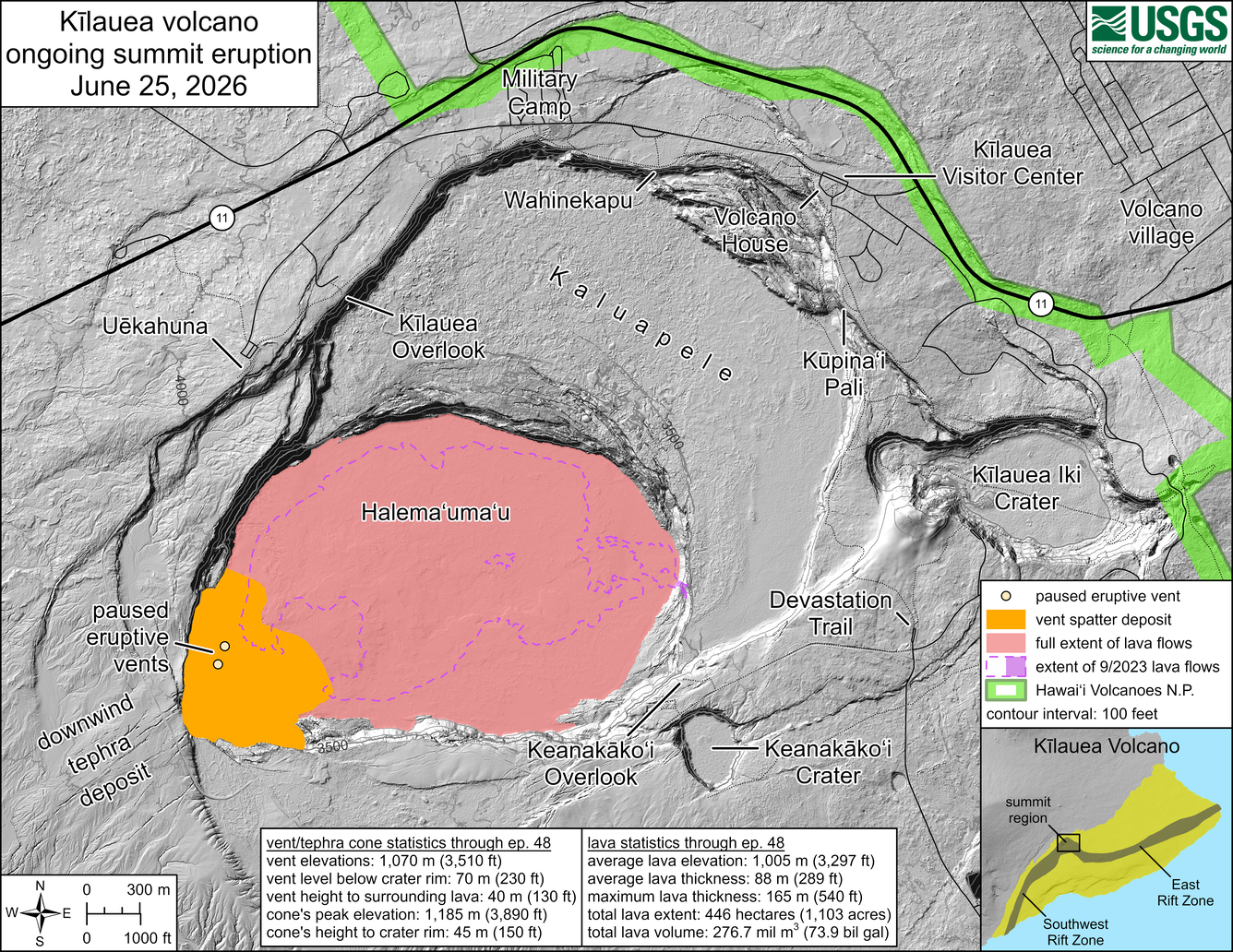
This reference map depicts the Kīlauea summit eruption within Halema‘uma‘u crater that began on December 23, 2024. Most of the data for this map were collected during a Hawaiian Volcano Observatory helicopter overflight on June 9, 2026. As such, the provided statistics are reflective of the first forty-eight episodes of the eruption through June 1, 2026. A forty-ninth lava fountaining episode occurred on June 14; its lava flows could not be mapped during the post-episode overflight yesterday, June 24, due to poor weather.
Eruptive vent and tephra cone statistics through episode 48:
Vent elevations: 1,070 meters (3,510 feet)
Vent level below crater rim: 70 meters (230 feet)
Vent height to surrounding lava: 40 meters (130 feet)
Cone's peak elevation: 1,185 meters (3,890 feet)
Cone's height to crater rim: 45 meters (150 feet)
Lava statistics through episode 48:
Average lava elevation: 1,005 meters (3,297 feet)
Average lava thickness: 88 meters (289 feet)
Maximum lava thickness: 165 meters (540 feet)
Total lava extent: 446 hectares (1,103 acres)
Total lava volume: 276.7 million cubic meters (73.9 billion gallons)