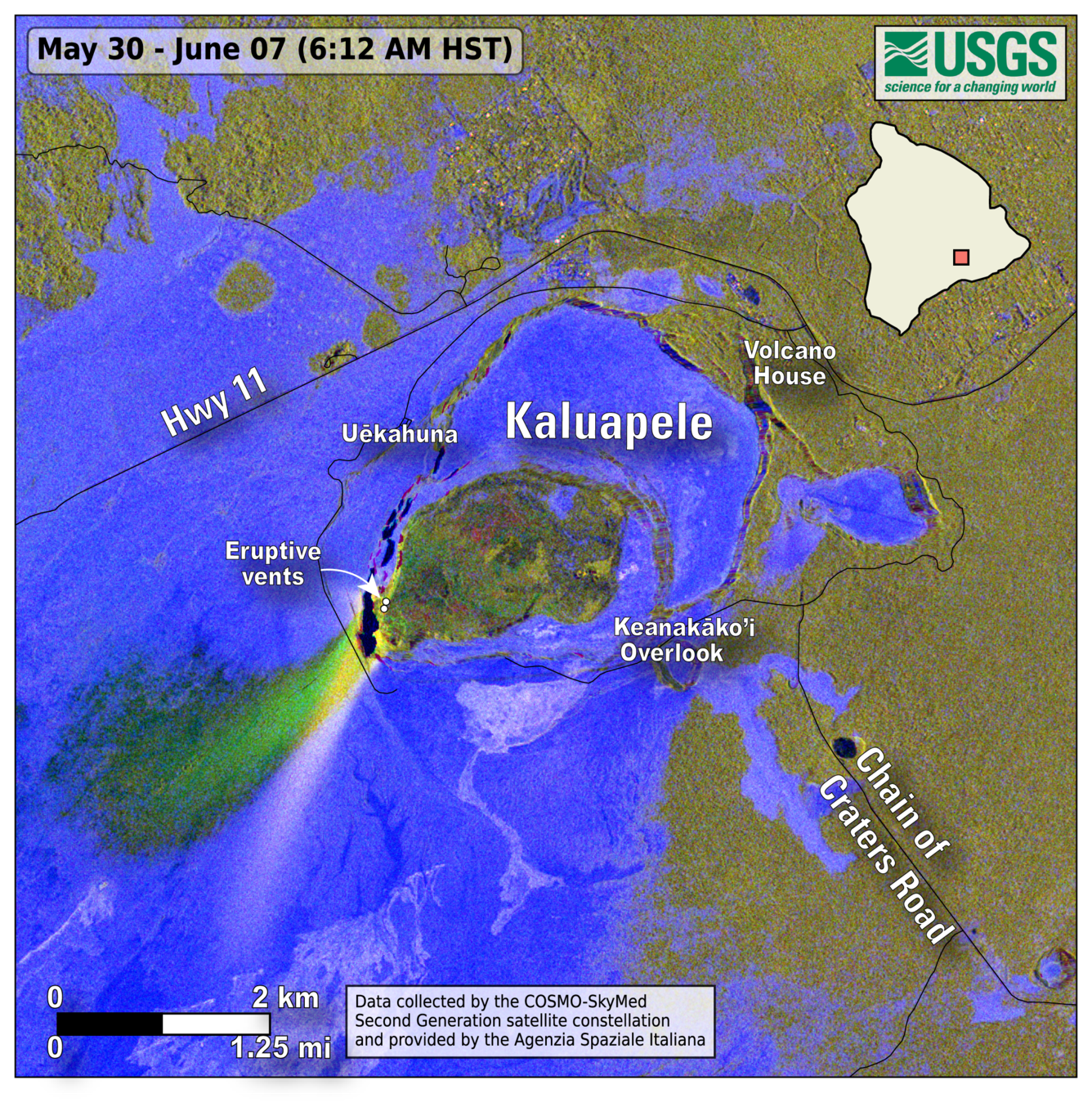
An official website of the United States government
Here's how you know
Official websites use .gov
A .gov website belongs to an official government organization in the United States.
Secure .gov websites use HTTPS
A lock () or https:// means you’ve safely connected to the .gov website. Share sensitive information only on official, secure websites.
This map shows lava flow and tephra accumulation at Kīlauea volcano associated with episode 24 of the ongoing eruption in Halemaʻumaʻu that started on December 23, 2024. The image covers the timespan from May 30–June 7, 2025, using data recorded by the Italian Space Agency's (ASI) COSMO-SkyMed Second Generation satellite constellation. This map combines cross-polarized radar amplitude images taken on two different dates, along with interferometric coherence from the time between those dates. This approach enables the detection of volcanic mass flows (such as lava flows) and other tephra-fall deposits regardless of surface or weather conditions. In the map, unchanged barren areas are represented in blue/purple, vegetated areas appear in yellow/light green, and new deposits over barren land are shown in either dark or bright green.
The bright green areas show the extent of lava flows in Halemaʻumaʻu and tephra that was deposited southwest of Halemaʻumaʻu during episode 24, when lava fountains were active for 7.5 hours on June 5-6. Tephra are volcanic fragments, such as Pele's Hair and scoria, that travel through the air before falling on the ground. Lava fountains during episode 24 reached up to 1200 ft (365 meters) and tephra was deposited nearly 2 miles (3 kilometers) from the vents. The white-ish streak to the south-southwest is the very reflective surface of the tephra deposits from episode 23.