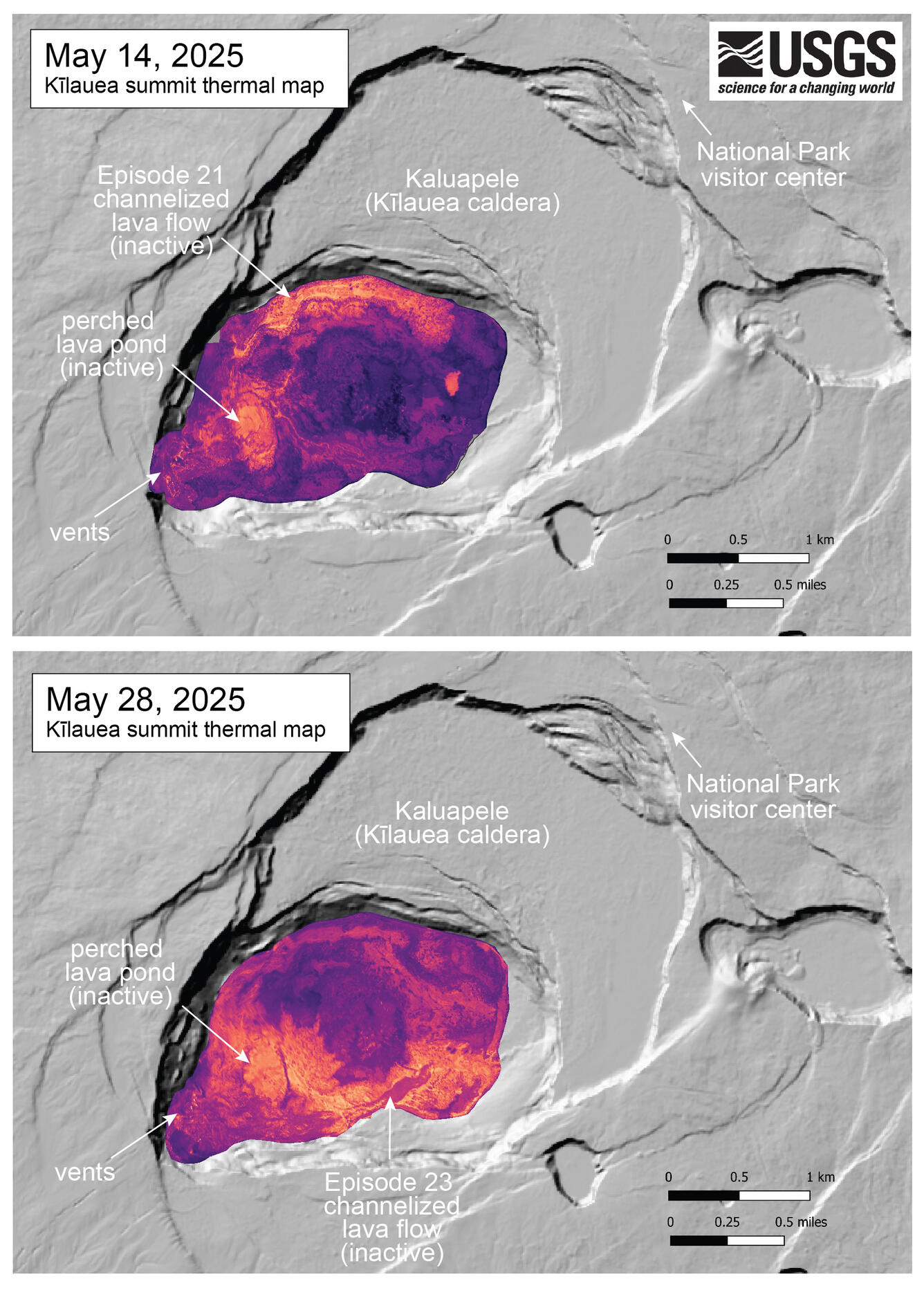
An official website of the United States government
Here's how you know
Official websites use .gov
A .gov website belongs to an official government organization in the United States.
Secure .gov websites use HTTPS
A lock () or https:// means you’ve safely connected to the .gov website. Share sensitive information only on official, secure websites.
This compilation shows thermal maps of Kīlauea summit collected on May 14 and 28, 2025. These maps followed episodes 21 and 23 of the ongoing Kīlauea summit eruption, respectively, and both show inactive but warm lava flows produced by the preceding lava fountaining episodes. The May 14 map shows the long, channelized lava flow produced by episode 21 that ran along the north perimeter of the crater floor, while the May 28 map shows the channelized flow from episode 23 that was guided along the south perimeter of the crater floor. Both thermal maps show a warm region in the western crater floor that has commonly hosted a perched lava pond during the lava fountaining phases.