



November 10, 2026—Kīlauea summit eruption reference map
November 10, 2026
Media
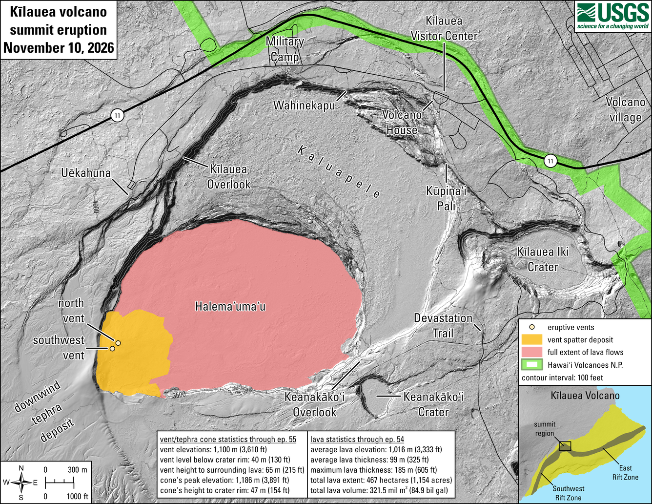
Sources/Usage: Public Domain. View Media Details
This reference map depicts the Kīlauea summit eruption within Halema‘uma‘u crater that began on December 23, 2024. The data for this map were collected during a USGS Hawaiian Volcano Observatory helicopter overflight on Wednesday, November 4, 2026; as such, the provided statistics are reflective of the first fifty-five episodes of the eruption through October 17. A fifty-sixth lava fountaining episode occurred Thursday, November 5, but its lava flows have not yet been fully mapped at this time.
Eruptive vent and tephra cone statistics through episode 55:
- Vent elevations: 1,100 meters (3,610 feet)
- Vent level below crater rim: 40 meters (130 feet)
- Vent height to surrounding lava: 65 meters (215 feet)
- Cone's peak elevation: 1,186 meters (3,891 feet)
- Cone's height to crater rim: 47 meters (154 feet)
Lava statistics through episode 55:
- Average lava elevation: 1,016 meters (3,333 feet)
- Average lava thickness: 99 meters (325 feet)
- Maximum lava thickness: 185 meters (605 feet)
- Total lava extent: 467 hectares (1,154 acres)
- Total lava volume: 321.5 million cubic meters (84.9 billion gallons)