U.S. flag

An official website of the United States government

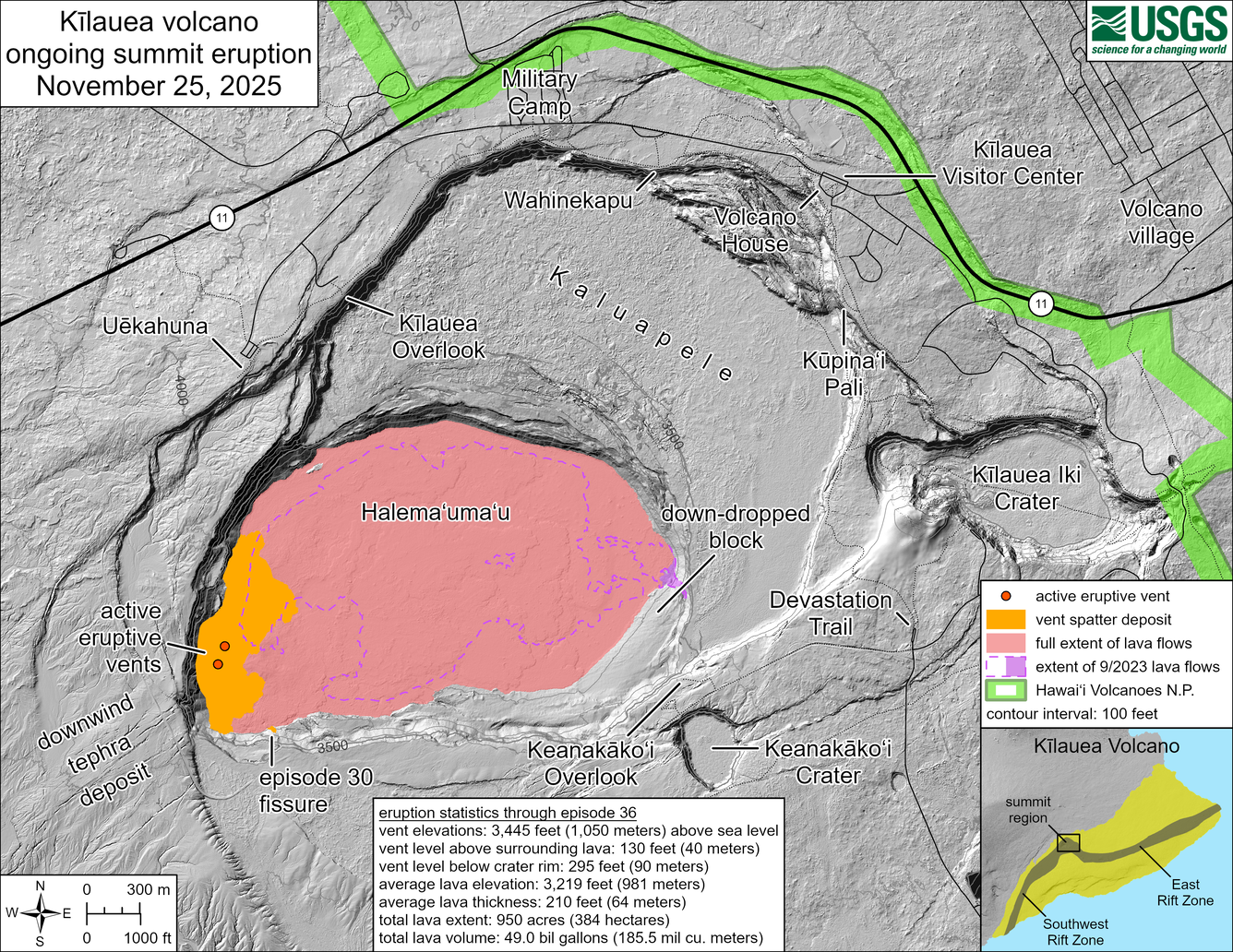
November 25, 2025—Kīlauea summit eruption reference map

November 25, 2025
Media
Color map showing area covered by lava flows in recent volcanic eruption
This reference map depicts the Kīlauea summit eruption within Halema‘uma‘u crater that began on December 23, 2024. The data for this map were collected during a Hawaiian Volcano Observatory helicopter overflight on November 24, 2025; as such, the provided statistics are reflective of the first thirty-six episodes of the eruption through November 9. A thirty-seventh lava fountaining episode occurred November 25, but its lava flows will be mapped in full during the next overflight, likely sometime next week.

Eruption statistics through episode 36:
Vent elevations: 3,445 feet (1,050 meters) above sea level
Vent level above surrounding lava: 130 feet (40 meters)
Vent level below crater rim: 295 feet (90 meters)
Average lava elevation: 3,219 feet (981 meters)
Average lava thickness: 210 feet (64 meters)
Total lava extent: 950 acres (384 hectares)
Total lava volume: 49.0 billion gallons (185.5 million cubic meters)


Was this page helpful?