
Michael Itzkin presents tools used to study coastal change
Detailed Description
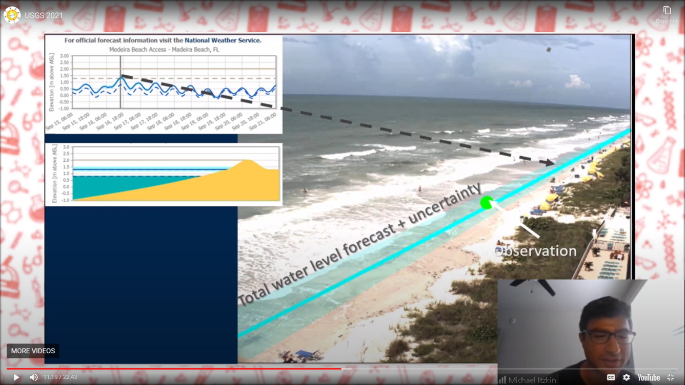
Detailed Description: The St. Petersburg Coastal and Marine Science Center shared USGS science at the annual St. Petersburg Science Festival via live, virtual sessions and pre-recorded video presentations. SPCMSC's live presentation during the festival’s “School Day” session taught students how water shapes our beaches and how USGS studies and predicts storm impacts. Here, SPCMSC scientist Michael Itzkin presents some of the tools used to measure total water levels to feed into and validate the USGS/NOAA Total Water Level and Coastal Change Forecast viewer.
Check out the recorded presentation at www.stpetescifest.org.
Sources/Usage
Public Domain.