
3D Hydrography Program FY24 Partnerships
Detailed Description
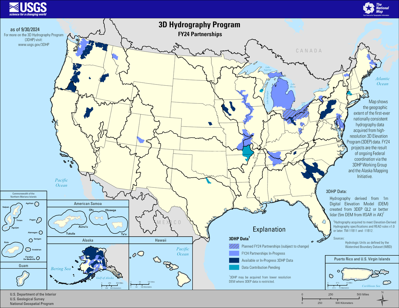
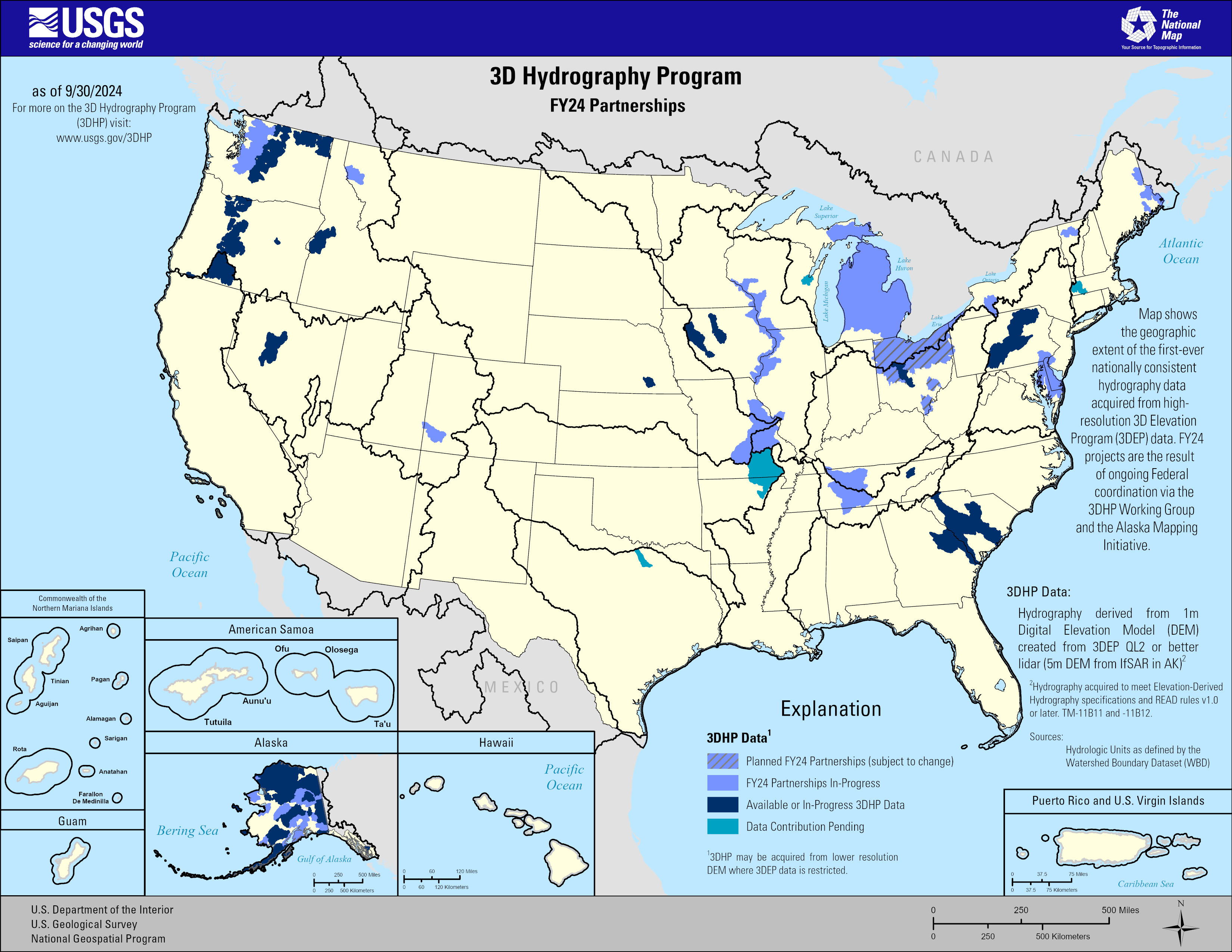
This map of the United States and its territories shows geographic extent of the first-ever nationally consistent hydrography data acquired from high-resolution 3D Elevation Program (3DEP) data. FY24 projects are the result of ongoing Federal coordination via the 3DHP Working Group and the Alaska Mapping Initiative.
Explanation
Available or in-progress data that meet 3DHP specification
Periwinkle Blue (striped) = Planned FY24 Partnerships (subject to change)
Periwinkle Blue = FY24 Partnerships
Medium Blue = Pending Contribution to 3DHP
Dark Blue = Available or In-Progress
3DHP Specifications
- Hydrography acquired to meet Elevation-Derived Hydrography specifications and READ rules v1.0 or later. TM-11B11 and -11B12.
- Publicly available
*Sources: Hydrologic Units as defined by the Watershed Boundary Dataset (WBD)
Sources/Usage
Public Domain.