
3D Hydrography Program FY25 Partnerships in Alaska
Detailed Description
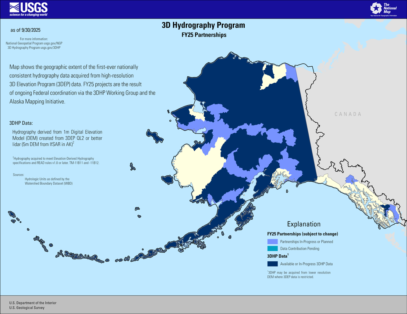
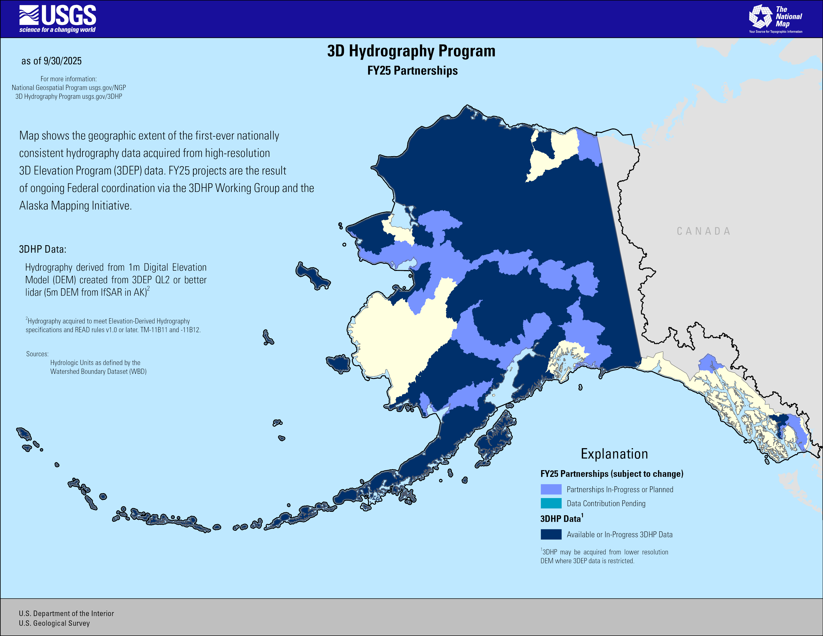
This map of Alaska shows geographic extent of the first-ever nationally consistent hydrography data acquired from high-resolution 3D Elevation Program (3DEP) data. FY25 projects are the result of ongoing Federal coordination via the 3DHP Working Group and the Alaska Mapping Initiative.
Explanation
FY25 Partnerships (subject to change)
Periwinkle Blue = FY25 Partnerships In-Progress or Planned
Medium Blue = Pending Contribution to 3DHP
3DHP Data1
Dark Blue = Available or In-Progress
Hydrography derived from 1m Digital Elevation Model (DEM) created from 3DEP QL2 or better lidar (5m DEM from IfSAR in AK)2
1 3DHP may be acquired from lower resolution DEM where 3DEP data is restricted
3DHP Specifications
2Hydrography acquired to meet Elevation-Derived Hydrography specifications and READ rules v1.0 or later. TM-11B11 and -11B12.
*Sources: Hydrologic Units as defined by the Watershed Boundary Dataset (WBD)
Sources/Usage
Public Domain.