
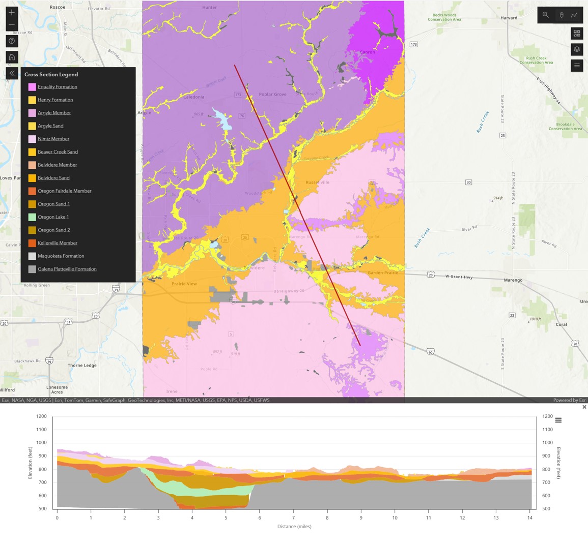
3D view of surficial geology and subsurface cross section within Boone County, IL

Detailed Description
This screen clipped image was generated with the Illinois State Geological Survey's 3D viewer. This map shows the surficial geology of Boon County, Illinois above a generated cross section along the red diagonal indicator line.
Sources/Usage
Public Domain.
This screenshot image has been used with the permission of the Illinois State Geological Survey.