
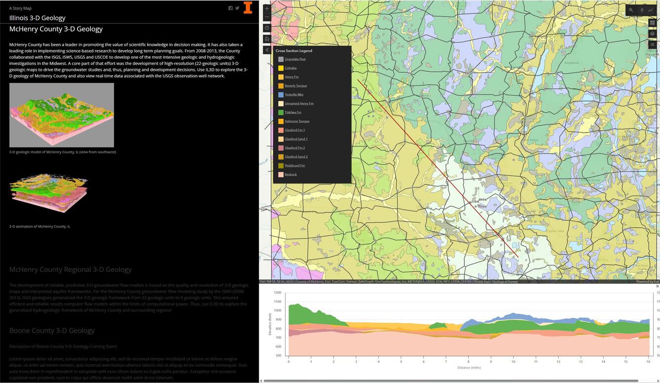
3D viewer screenshot from within McHenry County, IL including cross section
Detailed Description
The screenshot was captured from the 3D web viewer tool created by Illinois State Geological Survey (ISGS). It shows the surficial geologic map of McHenry County, IL in the upper right panel and a 3D cross section developed by the 3D tool in the lower right panel below the geologic map. The cross section location is indicated by the dashed line in the geologic map panel.
Sources/Usage
Public Domain.
This image is used with the permission of the Illinois State Geological Survey.