
A photo of a valley.
By Geology and Ecology of National Parks
June 1990 (approx.)

Detailed Description
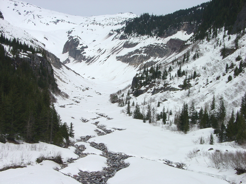
U-shaped valley looking upstream from the bridge over Nisqually Creek (draining from the toe of Nisqually Glacier on the south flank of Mount Rainier). Although most of the eruptive formation of the Mount Rainier Volcano occurred before the last major glaciation period of the Pleistocene Epoch, geologic forces are still changing the landscape; Eruptions of steam and tephra can trigger avalanches and debris flows, and lahars pose a major hazard to people living in valleys in the regional valleys and lowlands around the volcano (Crandell and Mullineaux, 1967).
Sources/Usage
A photo of a valley.