
A photo of The Monterey Formation.

Detailed Description
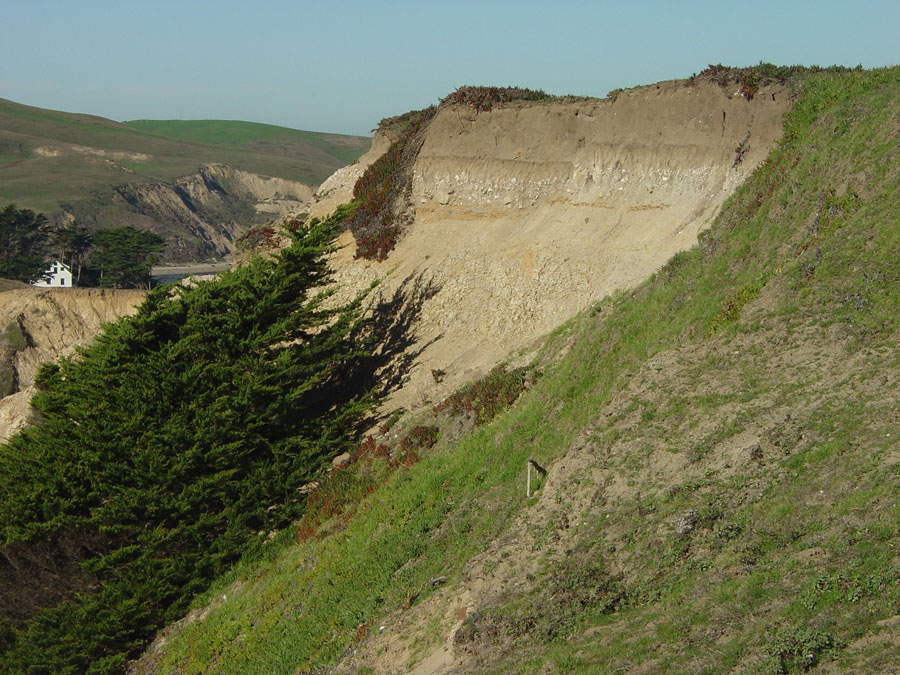
Landsliding associated with coastal erosion has exposed an angular unconformity between weathered siliceous sedimentary rock of the Monterey Formation and gravel of an ancient marine terrace. The gravel below the dark gray-brown sandy soil of the marine terrace deposits contains clasts derived mostly from the Point Reyes Conglomerate of Galloway (1977). The conglomerate is missing from this area, but is exposed near the Lighthouse on Point Reyes. Note the trees sculpted by wind. Wind is a significant force of erosion along this exposed, cliffy coastline. Uplifted marine terraces help geologists measure the rate of uplift along rising sections of the coastline. The Historic Point Reyes Lifeboat Station is visible on the left side of the photo in the distance.
Sources/Usage
A photo of The Monterey Formation.