



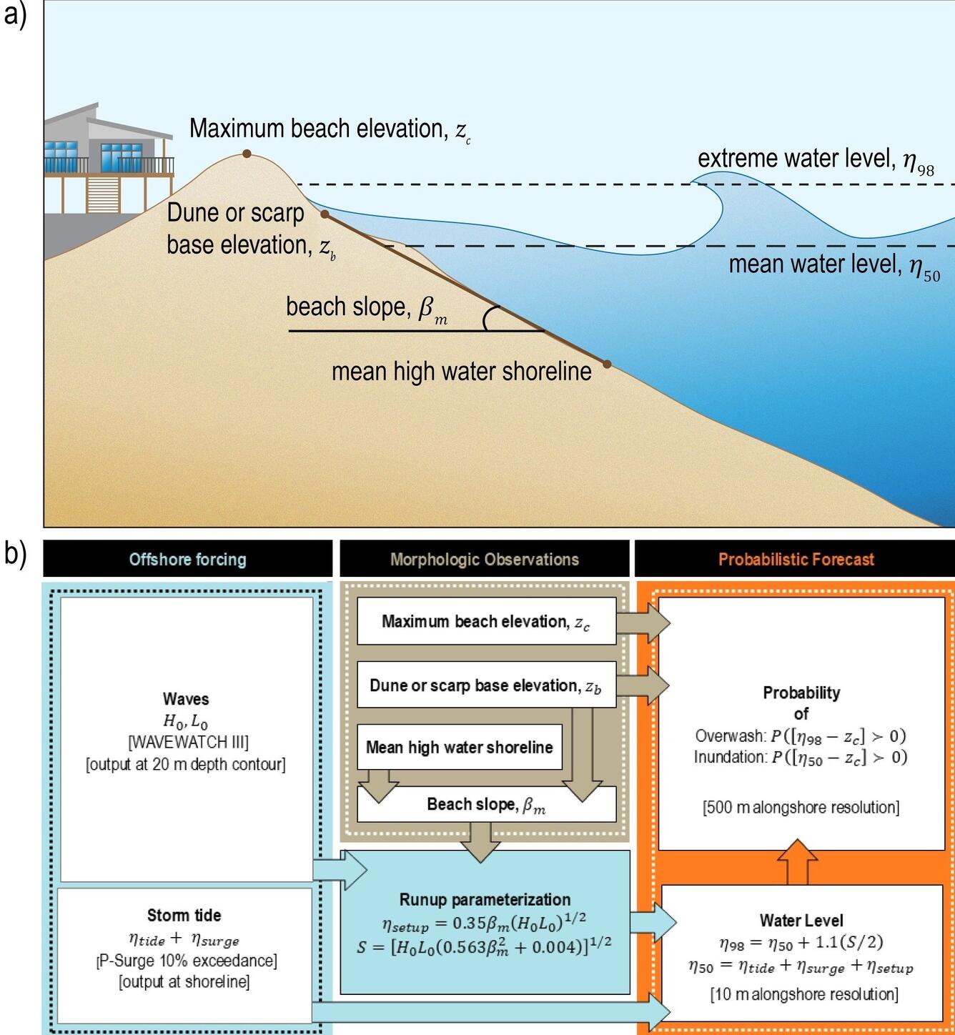
A schematic representation of mean water level and extreme or total water level referenced to a beach complex
By St. Petersburg Coastal and Marine Science Center
2025 (approx.)


Detailed Description
a) A schematic representation of mean water level (h50) and extreme water level (h98, (or total water level) referenced to a beach complex where beach slope (bm), shoreline, dune base (zb), and dune crest (zc) have all been calculated. b) The models used and calculations employed in the predictive model in order to determine the storm impact regime for a beach during an elevated water event (typically, but not restricted to, a hurricane).
Sources/Usage
Public Domain.