



American Samoa volcano monitoring network
Detailed Description
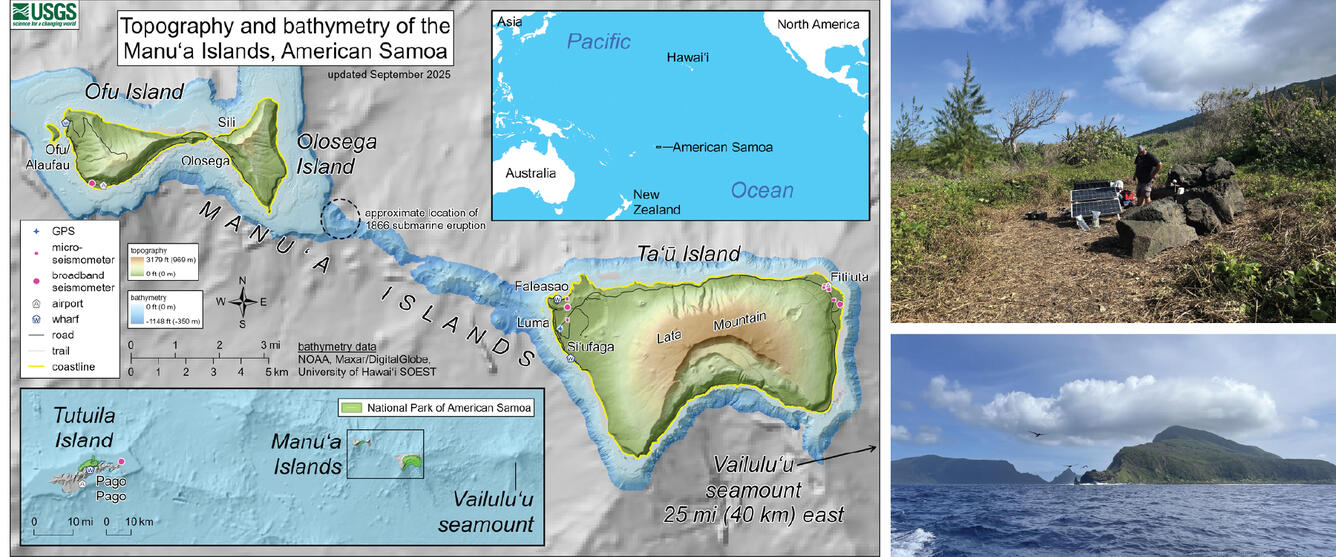
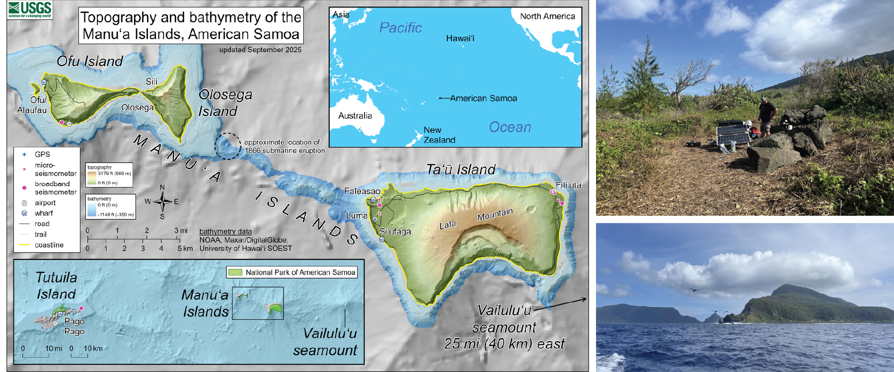
On the left is a map with an upper inset showing the location of American Samoa in the South Pacific Ocean, a lower inset showing the overall volcano monitoring network of the territory, and the main map showing the topography and bathymetry of the Manua Islands along with the current monitoring network (unchanged since September 2025). The upper right photo shows HVO staff doing critical maintenance on a seismic station. The lower right photo was taken during a channel crossing from Ofo-Olosega to Taʻū, very close to the likely location of the 1866 eruption. Olosega Island is on the right, and Ofu Island is on the left in the background.
Sources/Usage
Public Domain.