Science Explorer
Mission Areas
Unified Interior Regions
Frequently Asked Questions
Education
Data and Tools
Maps
Publications
Software
Multimedia Gallery
Park Passes
USGS Library
Featured Stories
News Releases
Science Snippets
Technical Announcements
Employees in the News
Get Our News
Media Contacts
I'm a Reporter
Headquarters
Locations
Contact Us
Staff Profiles
Social Media
About Us
Organization
Key Officials
Congressional
Budget
Opportunities
Doing Business
Emergency Management
Survey Manual
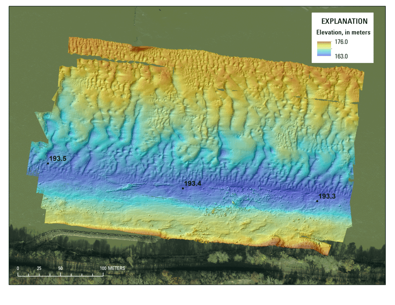
Animation showing three multibeam echosounder surveys of the Missouri River on July 15, 2015. Discharge was 112,000 cubic feet per second and surveys were about 1 hour apart.
Image Dimensions: 4400 x 3400
Location Taken: US