
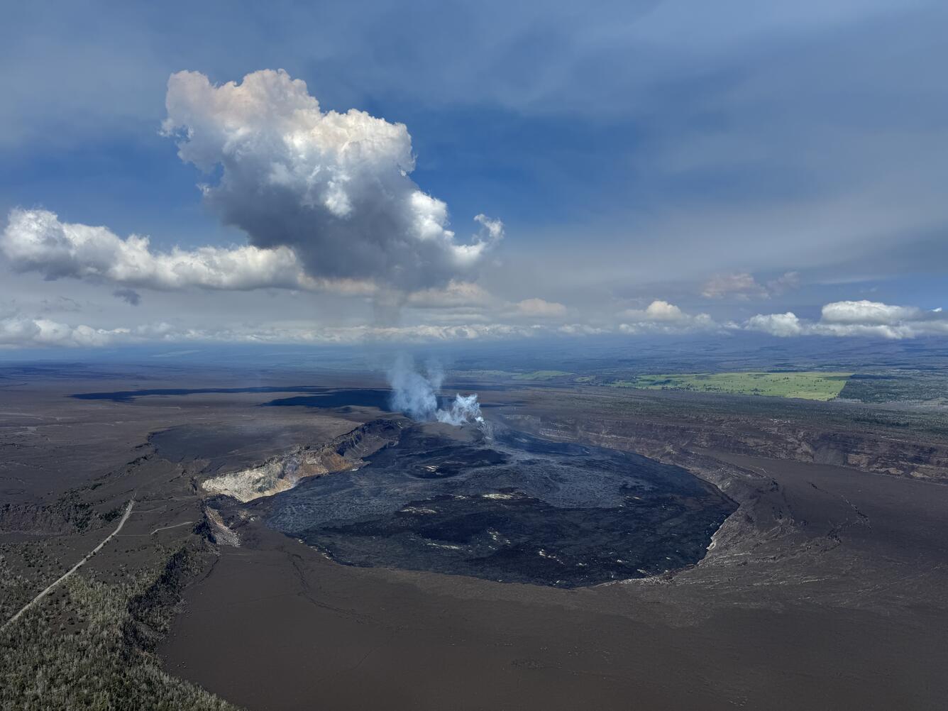
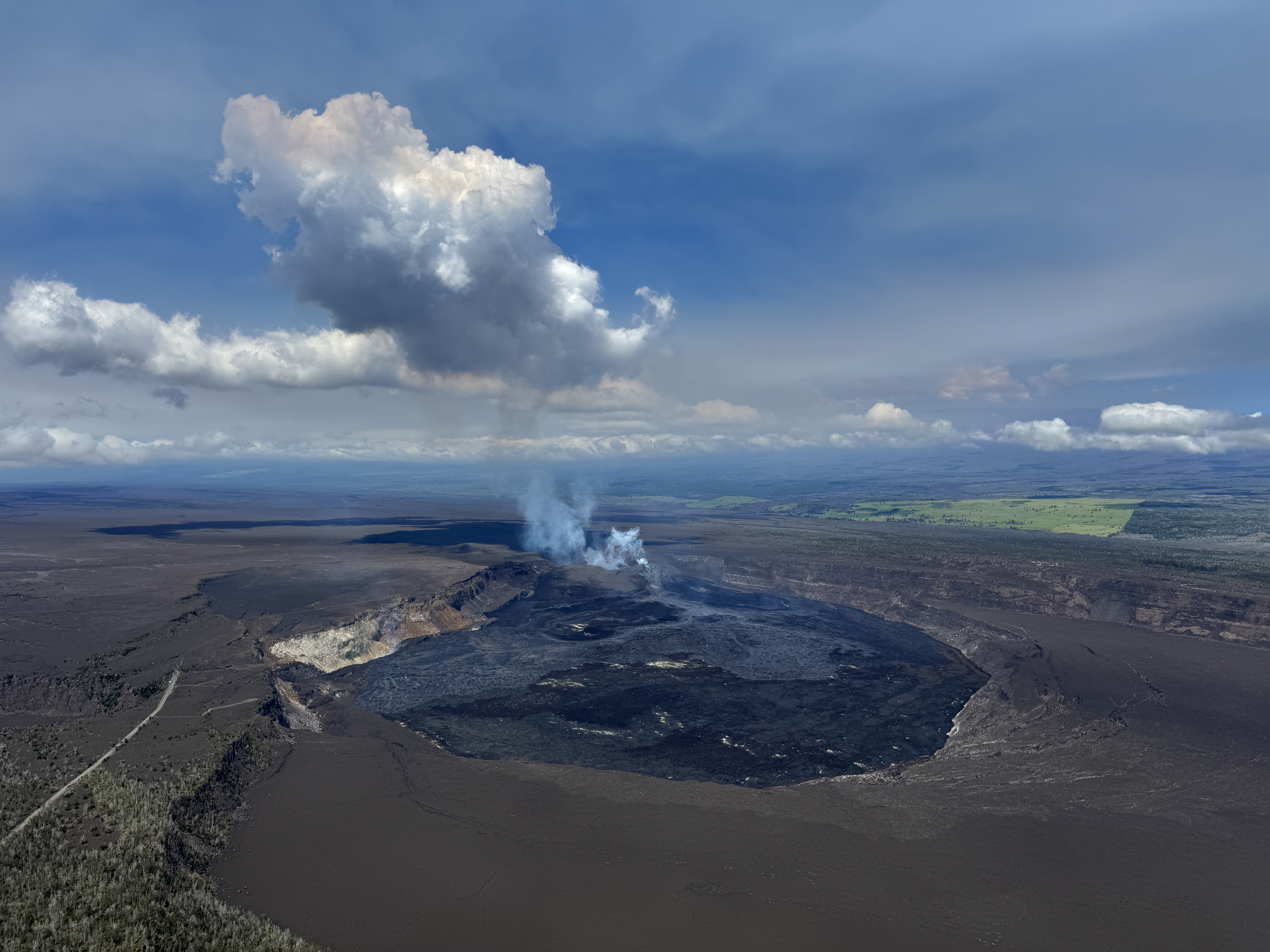
April 23, 2026 — Kīlauea summit aerial overview
Detailed Description
USGS Hawaiian Volcano Observatory geologists conducted a summit monitoring overflight shortly after the end of episode 45 to collect visual and thermal imagery of Halema‘uma‘u crater and new lava flows in order the map the extent of the new deposits at Kīlauea summit. The episode 45 lava flows are the lighter portions of the crater floor in this view. USGS photo by M. Patrick.
Sources/Usage
Public Domain.