
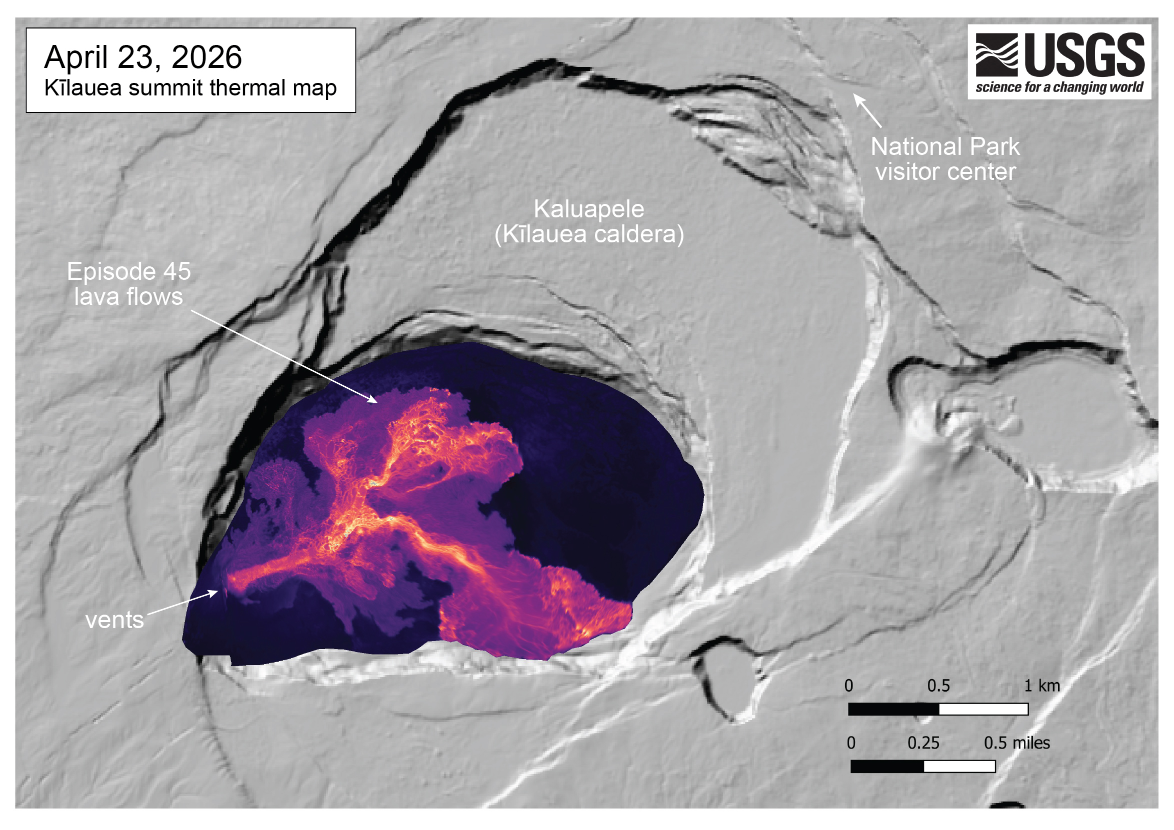
April 23, 2026 — Thermal map of episode 45 lava flows at the summit of Kīlauea

Detailed Description
This thermal map was made from thermal images collected during an overflight immediately after the end of Kīlauea summit episode 45 lava fountaining on April 23, 2026. The thermal map shows a single channelized lava flow extending from the north vent, splitting into branching lava channels in the central part of the crater floor. Individual lobes of lava then extend out to the northeast and southeast, into the eastern portion of the Halema‘uma‘u crater.
Sources/Usage
Public Domain.
Related

Eruption Information
Eruptive activity at the summit of Kīlauea, within Hawaiʻi Volcanoes National Park, has been episodic since an eruption began on December 23, 2024.
Related
Eruption Information
Eruptive activity at the summit of Kīlauea, within Hawaiʻi Volcanoes National Park, has been episodic since an eruption began on December 23, 2024.