
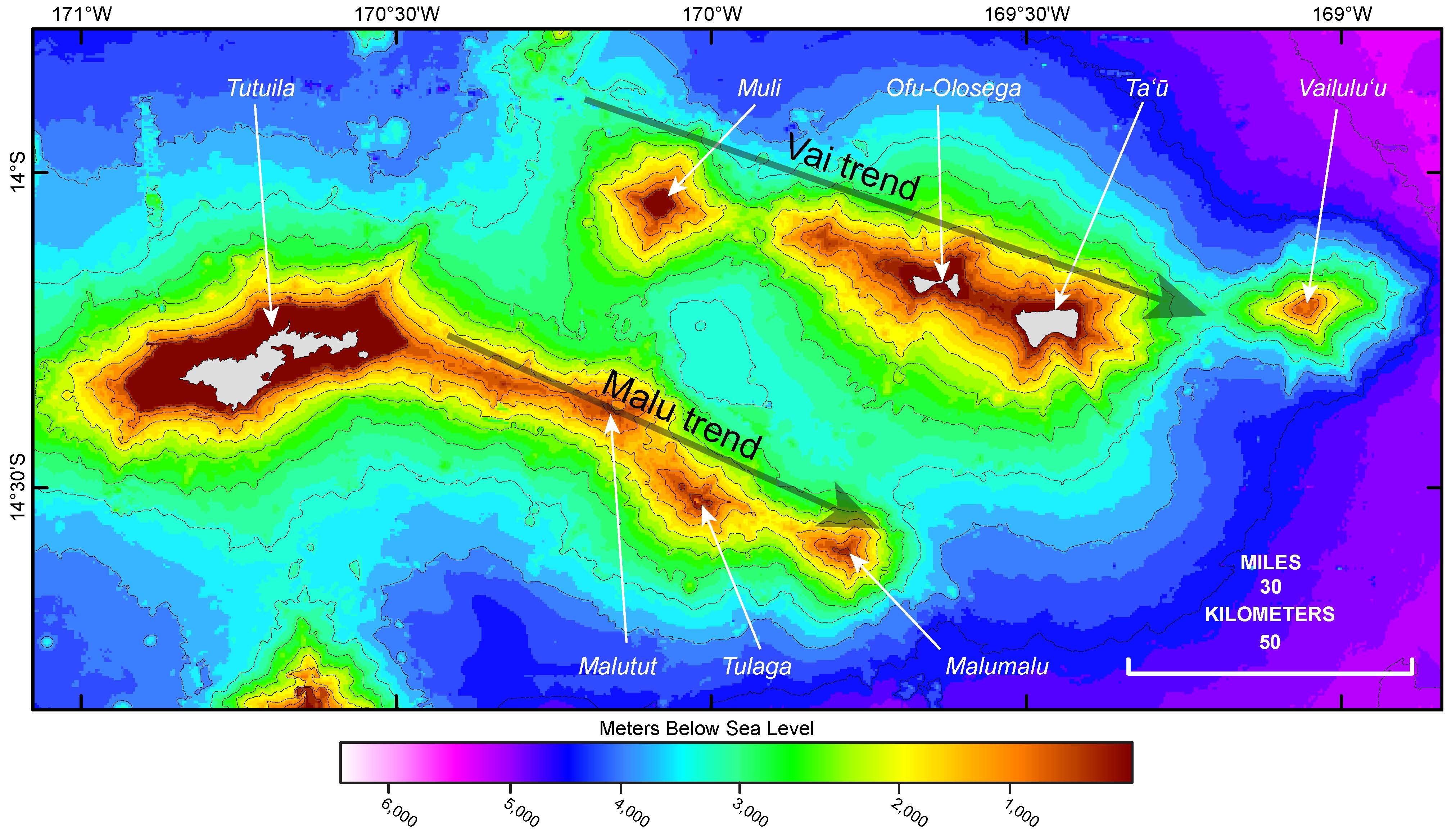
Bathymetric data from the National Oceanic and Atmospheric Administration (NOAA) collected around American Samoa

Detailed Description
Bathymetric data from the National Oceanic and Atmospheric Administration (NOAA) collected around American Samoa. Light gray areas are the islands of Tutuila, Ofu-Olosega, and Taʻū. Black lines are 1,640 ft (500 m) contour intervals below sea level. The Samoan hotspot has created volcanoes along two tracks, the Vai (to the north) and Malu (to the south) trends, but with most of the volcanoes remaining below sea level as seamounts. The Samoan hotspot is thought to be near the easternmost seamount of Vailuluʻu.
Sources/Usage
Public Domain.