
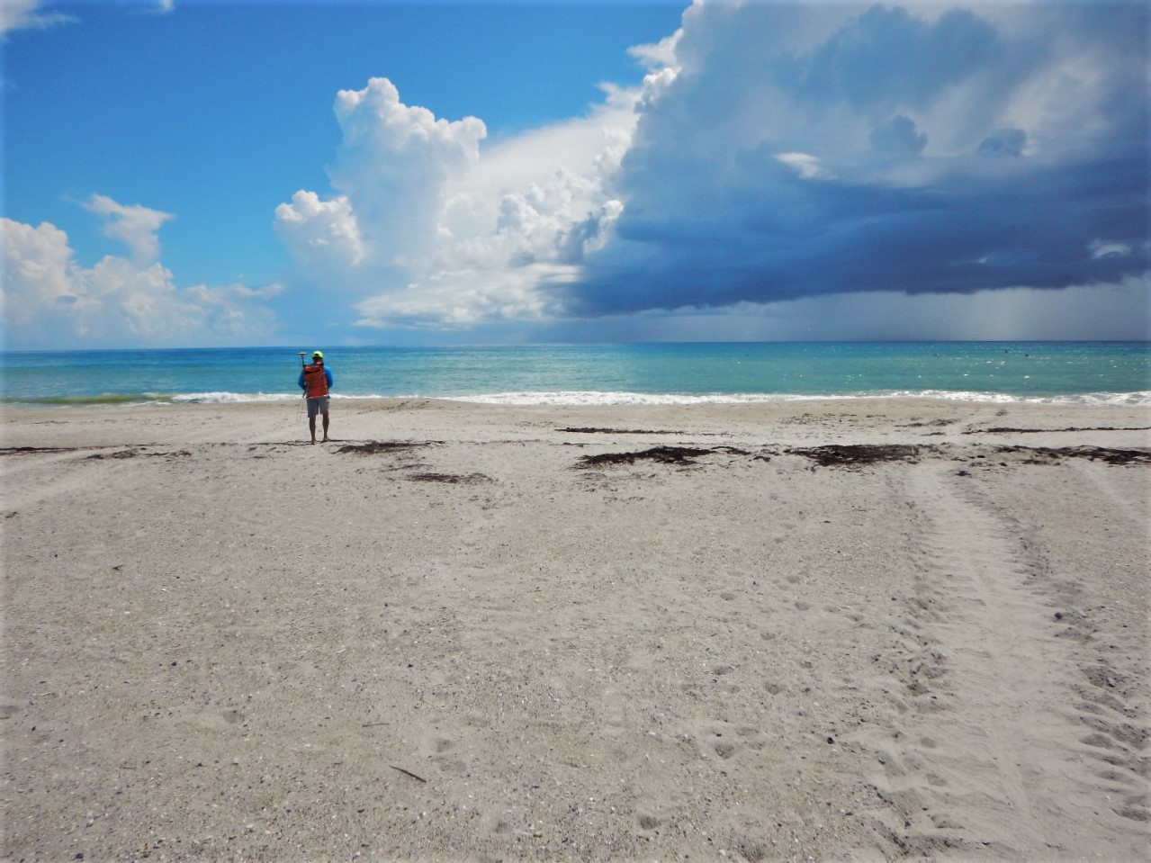
Beach profile data collection near a sea turtle nest

Detailed Description
Scientists RC Mickey and Dave Thompson from the USGS St. Petersburg Coastal and Marine Science Center are conducting beach surveys on nourished beaches (where sand has been added) to study influences on green sea turtle (Chelonia mydas) and loggerhead sea turtle (Caretta caretta) nesting. Here, a turtle track can be seen on the right extending down to the ocean.
This is a five-year collaborative study investigating sea turtle nesting on recently nourished beaches. The primary goal is to quantify beach parameters that may influence sea turtle nesting on nourished beaches as these beaches typically display rapid (2 to 3 years) reshaping by ocean waves. The results of the study can then be used to suggest improvements beach nourishment design such that impacts to sea turtle nesting are minimized. USGS is working with partners at US Fish and Wildlife (USFW), Florida Fish and Wildlife Conservation Commission (FWC) and University of South Florida (USF) on this National Fish and Wildlife Foundation (NFWF) funded study.
USGS's role is to map (position and elevation) the beach profile from the water line into the dune, and map turtle crawl paths at nesting decision locations using precise GPS. These GPS surveys are conducted monthly for two consecutive days during the height of sea turtle nesting season (May through September). The surveys have been conducted at four nourished beaches that also have high-density of sea turtle nesting, including Melbourne Beach, Jensen Beach, Jupiter Island, and Juno Beach. The GPS data is processed to quantify various beach parameters, including water line, dune toe, dune top, and locations of nests or false crawl apex (landward point that turtle crawled and decided not to nest) locations.
Sources/Usage
Public Domain.