
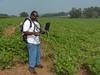
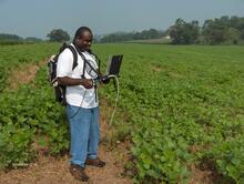
Bernard Hubbard Ground-Truthing Remote Sensing

Detailed Description
USGS scientist Bernard Hubbard conducting spectral measurements of soils and cover crops to ground truth satellite imagery being used to map soil erosion and runoff potential into the Chesapeake Bay watershed.
Sources/Usage
Public Domain.