
Black Hills Dome
By Geology and Ecology of National Parks
1978 (approx.)
Detailed Description
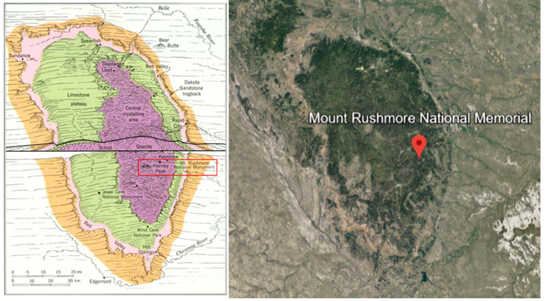
A stratigraphic map (left) vs. satellite imagery (right) of the Black Hills dome. The stratigraphic map contains a cross-section at its center (outlined in black). Erosion of the top portion of the dome has exposed ancient rocks. As a result of uplift, rocks closer to the center of the dome are older than those closer to the perimeter. Mount Rushmore is located in the oldest region of rock: the crystalline core. NPS.
Sources/Usage
Public Domain.
Left image by A.N. Strahler, NPS. Right image from Google Earth.