
Cape Hatteras National Seashore

Detailed Description
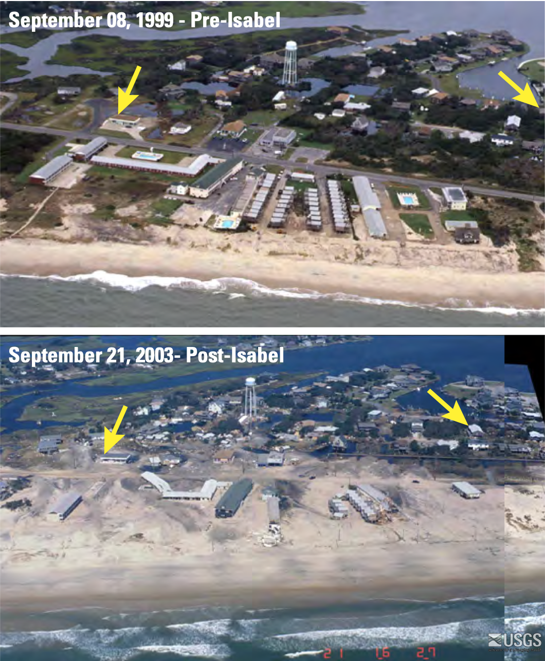
Aerial imagery from a report by Karen Morgan of the USGS on coastal change on Cape Hatteras associated with Hurricane Isabel. The tops image shows Hatteras Village before Hurricane Isabel and the bottom images shows the aftermath of the hurricane at the same location. Storm surge and waves moved sand across the island, tore buildings from their foundations, and washed away the dunes. Yellow arrows point to the same location in both photographs.
Sources/Usage
Public Domain.