
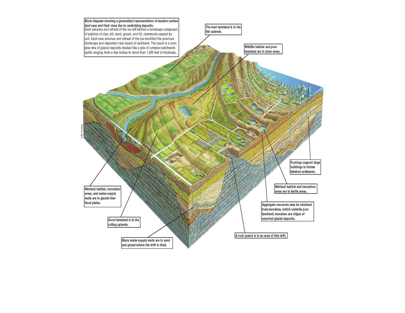
Central Great Lakes Geologic Mapping Coalition (1999): USGS Circular 1190 block diagram showing a generalized representation of modern surface land uses and their close ties to underlying deposits.
By National Cooperative Geologic Mapping Program
1999 (approx.)
Detailed Description
Each advance and retreat of the ice sheet left behind a landscape composed of patches of clay, silt, sand, gravel and till, commonly capped by soil. This block diagram provides an artistic depiction of a modern landscape on glacial deposits.
Sources/Usage
Public Domain.
Block diagram developed by J.M. Evans. Citation: Central Great Lakes Geologic Mapping Coalition, Illinois State Geological Survey Indiana Geological Survey Michigan Geological Survey Division Ohio Division of Geological Survey U.S. Geological Survey, 1999, Sustainable Growth in America’s Heartland— 3-D Geologic Maps as the Foundation, U.S. Geological Survey Circular 1190.