
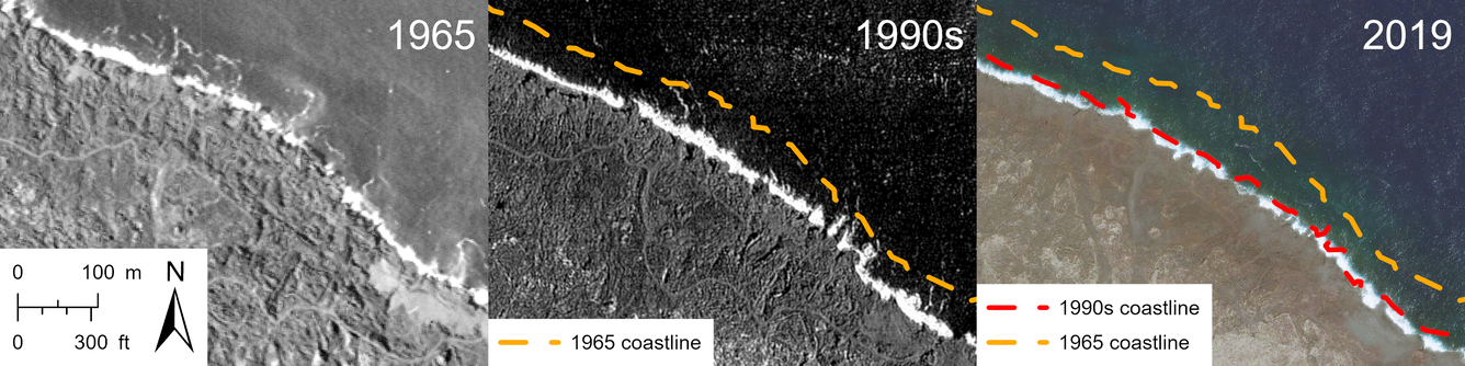
Changes to Kīlauea 1960 lava delta over time
Detailed Description
Aerial imagery time-series showing erosion along the northern edge of the 1960 lava delta spanning six decades after the eruption. The 1965 aerial photo on the left is from the U.S. Department of Agriculture, the 1990s satellite image in the center is from Spot Image, and the 2019 satellite image is from Maxar.
Sources/Usage
Public Domain.