
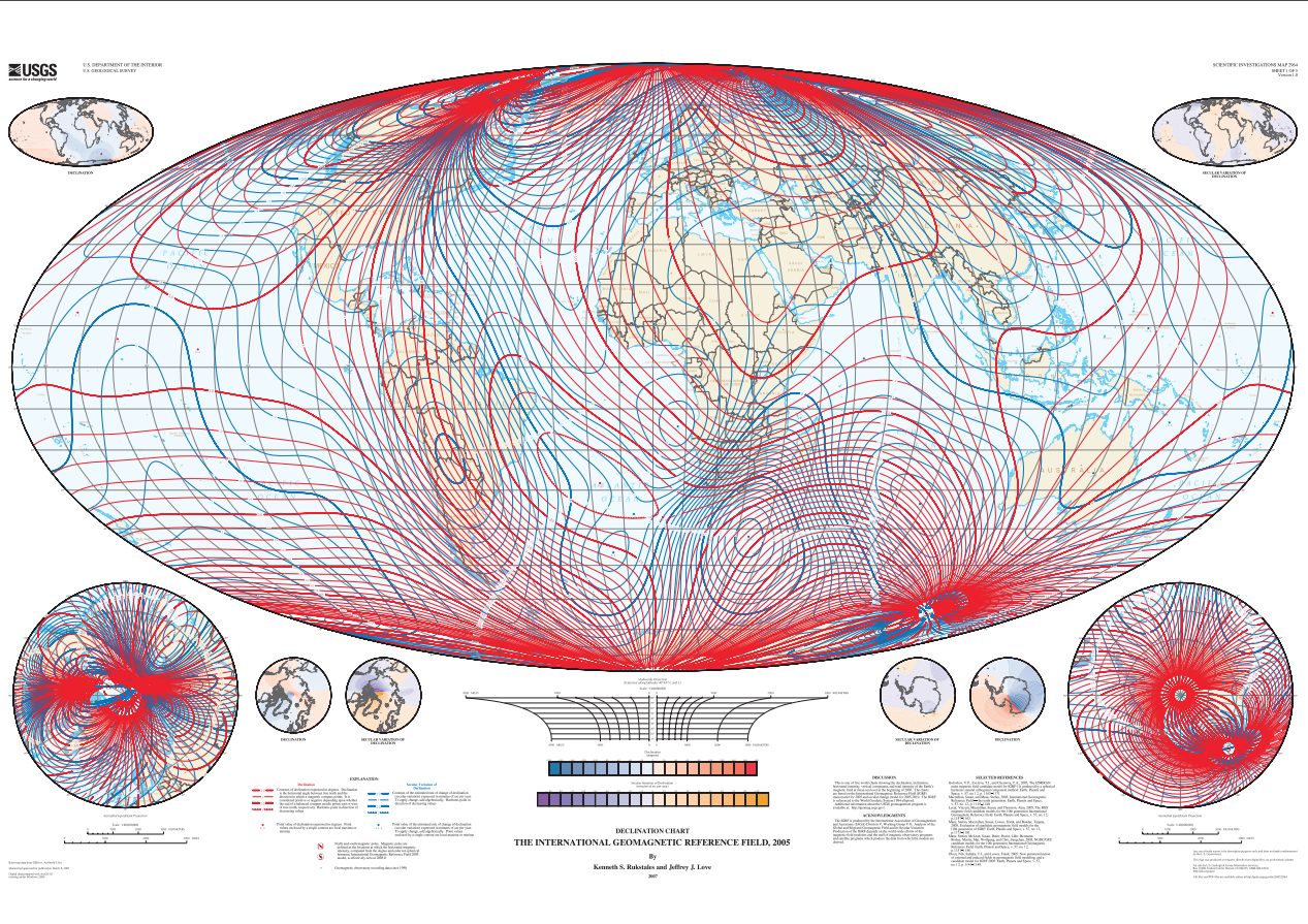
Chart showing the Earth’s magnetic field

Detailed Description
This is one of five world charts showing the declination, inclination, horizontal intensity, vertical component, and total intensity of the Earth’s magnetic field at mean sea level at the beginning of 2005. The charts are based on the International Geomagnetic Reference Field (IGRF) main model for 2005 and secular change model for 2005-2010. The IGRF is referenced to the World Geodetic System 1984 ellipsoid.
Sources/Usage
Public Domain.