
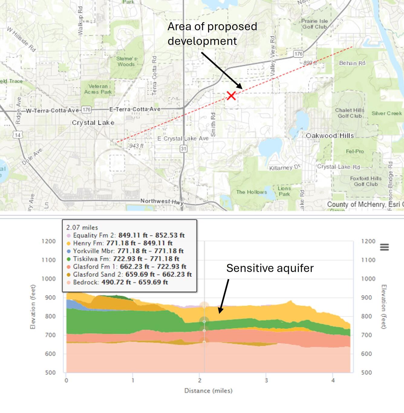
Cross section within McHenry County, IL created with 3D viewer along area of proposed development
By National Cooperative Geologic Mapping Program
2025 (approx.)
Detailed Description
This image shows a street map within McHenry County, Illinois (above). The red line indicates the location of the geologic cross section (below). The red line shows an area of proposed development and the cross section indicates the existence of a sensitive aquifer along that locator line.
Sources/Usage
Public Domain.
This image is used with the permission of the Illinois State Geological Survey.
Related
GLGMC Science in Action
The testimonials below demonstrate the impact of recent geologic mapping projects carried out by the GLGMC.
Related
GLGMC Science in Action
The testimonials below demonstrate the impact of recent geologic mapping projects carried out by the GLGMC.