
December 11, 2025—Kīlauea summit eruption reference map
Detailed Description
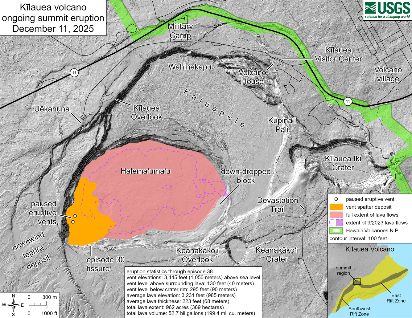
This reference map depicts the Kīlauea summit eruption within Halema‘uma‘u crater that began on December 23, 2024. As of this posting on December 11, 2025, the eruption has had thirty-eight episodes, with the most recent occurring on December 6. Most of the map data included here were collected during a USGS Hawaiian Volcano Observatory helicopter overflight on December 9, so the provided statistics are reflective of the entire eruption to this point. Eruption statistics through episode 38:
- Vent elevations: 3,445 feet (1,050 meters) above sea level
- Vent level above surrounding lava: 130 feet (40 meters)
- Vent level below crater rim: 295 feet (90 meters)
- Average lava elevation: 3,231 feet (985 meters)
- Average lava thickness: 223 feet (68 meters)
- Total lava extent: 962 acres (389 hectares)
- Total lava volume: 52.7 billion gallons (199.4 million cubic meters)
Sources/Usage
Public Domain.