
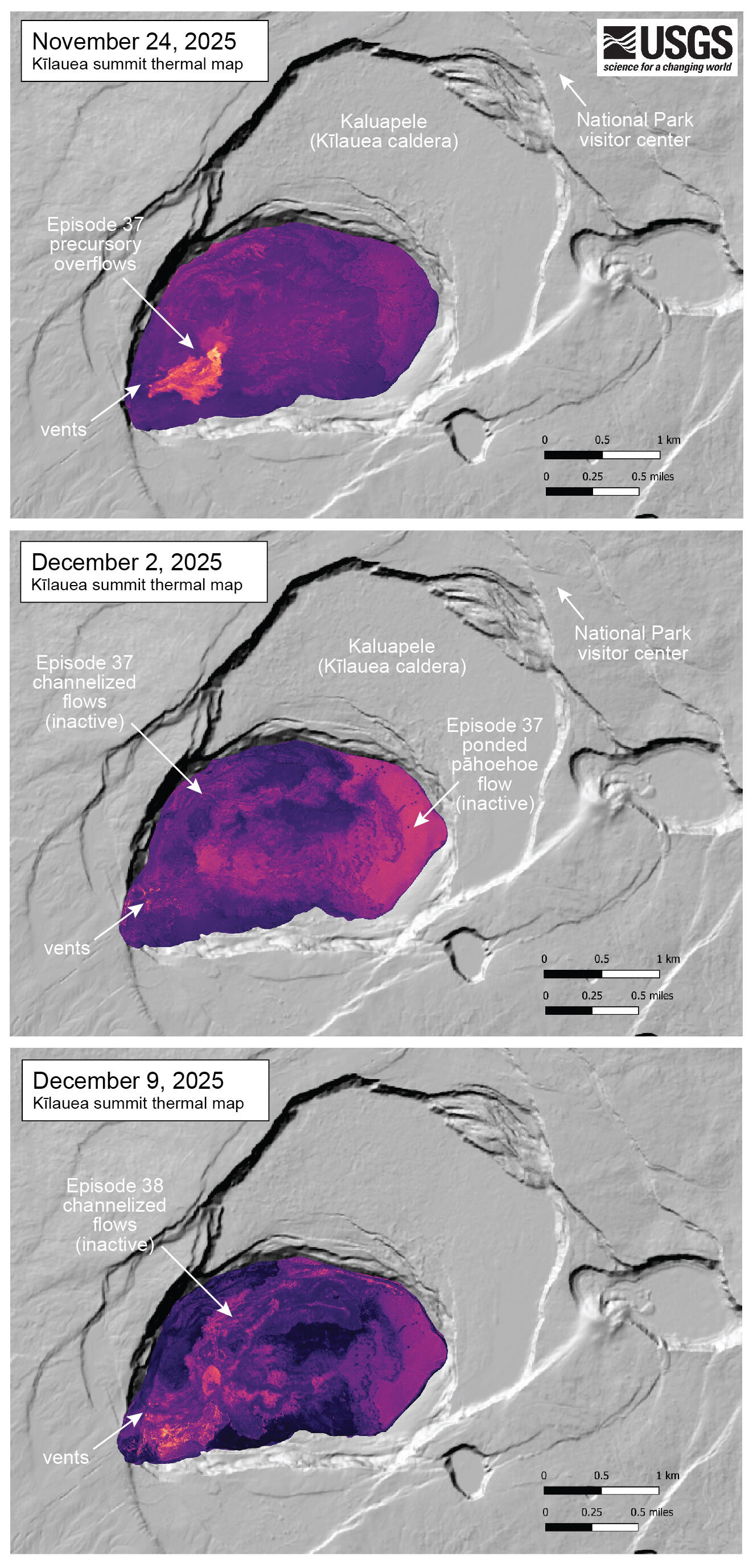
December 9, 2025 — Kīlauea summit thermal maps bracketing episodes 37 and 38
Detailed Description
These three thermal maps were made from oblique thermal images collected during helicopter overflights of Kīlauea summit. The collection dates bracket the last two episodes of lava fountaining - episode 37 was on November 25 and episode 38 was on December 6. The November 24 thermal map shows small flows erupted in the precursory phase of episode 37, just before fountains sent flows across the crater floor. The December 2 map shows these eastern flows as a broad region of ponded pāhoehoe that is still warm. The December 9 map shows the thermal signature of channelized flows erupted during episode 38, though these did not reach the eastern tip of the crater floor. USGS map by M. Patrick.
Sources/Usage
Public Domain.