
Electronic Tilt at Kīlauea Summit and East Rift Zone - Past Week
By Kīlauea
2019 (approx.)
Detailed Description
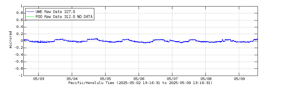
Electronic Tilt at Kīlauea Summit and East Rift Zone - Past Week. The blue line shows the radial tilt at Uwekahuna station (UWE), on the western rim of Kīlauea's caldera. The green line is radial tilt at Pu‘u‘ō‘ō (POO), north of Pu‘u‘ō‘ō cone; this instrument is currently experiencing a long-term outage. These are recorded by continuously operating electronic tiltmeters. Positive changes often indicate inflation of the magma storage areas beneath the caldera or Pu‘u‘ō‘ō, but may also result from heavy rainfall or, occasionally, instrumental malfunctions.
Sources/Usage
Public Domain.