
Elevation difference maps of Assateague Island, Maryland
Detailed Description
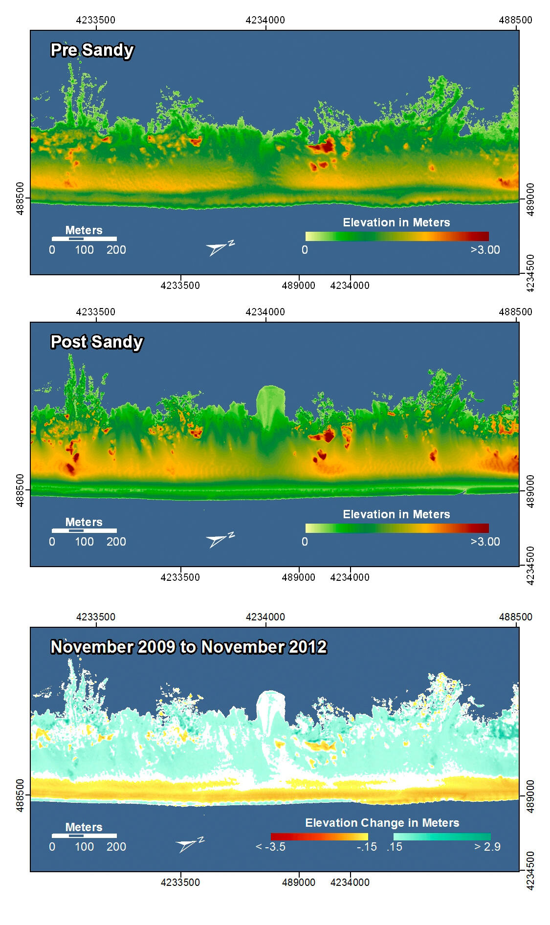
Assateague Island, Maryland. The pre-storm map shows a narrow, low-lying area that crosses the island from front to back. In the post-storm and difference maps, waves and surge deposited sand into the bay as an overwash fan and widened the island at this location. Beach erosion and overwash deposition occurred uniformly along this section of the barrier island.
In the pre- and post-storm elevation maps, orange and red colors indicate higher elevations while yellow and green colors indicate lower elevations. In the elevation difference maps, red colors indicate erosion such as shoreline retreat, and blue-green colors indicate accretion, such as overwash deposits where waves and surge have moved sand landward. Maps are oriented with the Atlantic Ocean on the bottom.
Sources/Usage
Public Domain.
k