
Elevation difference maps of Assateague Island, Virginia

Detailed Description
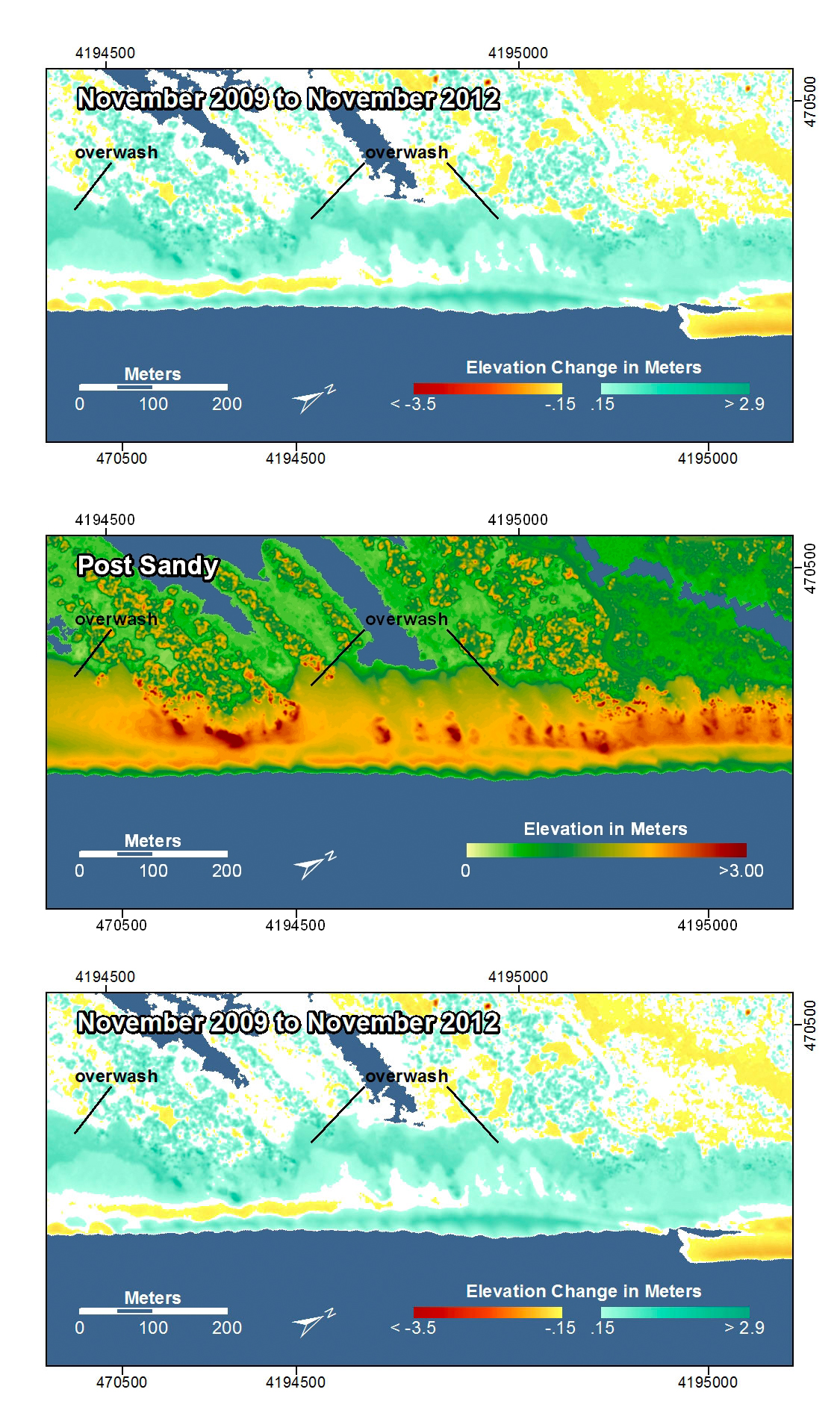
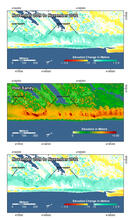
Assateague Island, Virginia. Along this stretch of the island, overwash deposits from earlier storms are evident in the pre-storm map. The pre-storm lidar was obtained after Nor'Ida (2009) but prior to Hurricane Irene (2011) so the change in the post-storm map incorporates both Irene and Sandy. (Note that in the photo comparisons of this location, the pre-storm photo was taken prior to both and Irene and Nor'Ida). The post-storm and difference maps show even more extensive overwash deposits in a thicker layer farther inland. The shoreline has moved seaward indicating the beach had been severely eroded after Nor'Ida and had recovered since then.
In the pre- and post-storm elevation maps, orange and red colors indicate higher elevations while yellow and green colors indicate lower elevations. In the elevation difference maps, red colors indicate erosion such as shoreline retreat, and blue-green colors indicate accretion, such as overwash deposits where waves and surge have moved sand landward. Maps are oriented with the Atlantic Ocean on the bottom.
Sources/Usage
Public domain