
Elevation difference maps of Pea Island National Wildlife Refuge

Detailed Description
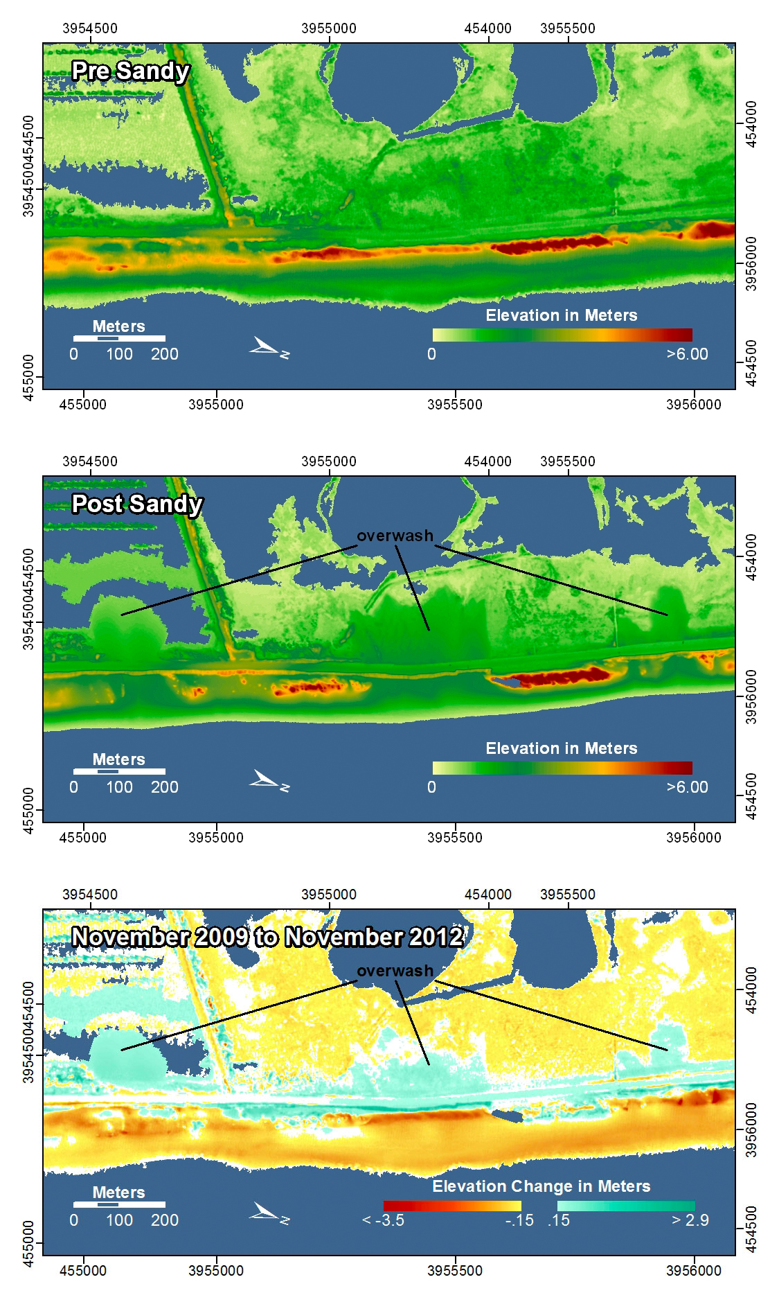
Pea Island National Wildlife Refuge, Kinnakeet, North Carolina. Prior to Hurricane Sandy, the dunes here varied in height and width. During Hurricane Sandy, the lower and narrower dunes were overwashed by the waves and storm surge that carried sand from the beach and dunes and deposited it on the road and marsh in overwash fans.
In the pre- and post-storm elevation maps, orange and red colors indicate higher elevations while yellow and green colors indicate lower elevations. In the elevation difference maps, red colors indicate erosion such as shoreline retreat, and blue-green colors indicate accretion, such as overwash deposits where waves and surge have moved sand landward. Maps are oriented with the Atlantic Ocean on the bottom.
Sources/Usage
Public Domain.
Public domain