
Estimated Net Annual Area Change in CONUS (LCMAP Reference Dataset)
By Land Change Monitoring, Assessment, and Projection
2019 (approx.)

Detailed Description
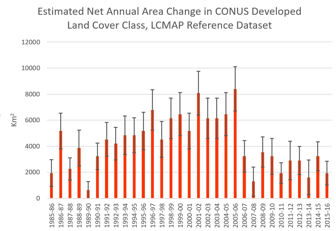
Estimated Net Annual Area Change in Developed Land Cover Classin Conterminous United States, based on USGS Land Cover Monitoring, Assessment, and Projection (LCMAP) Reference Dataset.
Sources/Usage
Public Domain.
Related

LCMAP Validation Data Captures Impact of U.S. Economic Downturn
The USGS Land Change Monitoring, Assessment, and Projection (LCMAP) initiative focuses on the creation of annual map products and the application of those products to advance the understanding of land surface change for the scientific community, the land management community, and the general public. Both the map products and the work performed to validate them offer insight into the multitude of...
Related
LCMAP Validation Data Captures Impact of U.S. Economic Downturn
The USGS Land Change Monitoring, Assessment, and Projection (LCMAP) initiative focuses on the creation of annual map products and the application of those products to advance the understanding of land surface change for the scientific community, the land management community, and the general public. Both the map products and the work performed to validate them offer insight into the multitude of...