
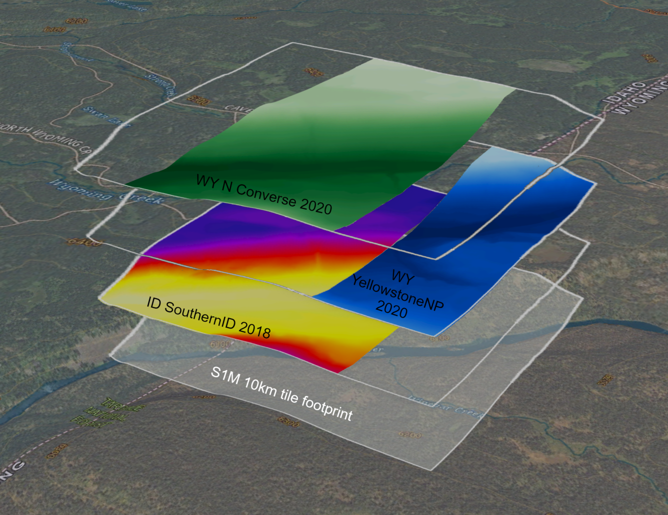
Fig 3 Teton_S1M_layer_stack
Detailed Description
The seamless 1m (S1M) product is an analysis-ready digital elevation model derived from 3DEP lidar projects. Within each 10 km by 10 km tile, vertical offsets and temporal differences between individual lidar projects are minimized using smoothing and blending methods and by prioritizing the most recent or highest quality lidar dataset. Spatial metadata is produced for the S1M to provide information on the source lidar project and data processing steps used to produce each pixel.
Sources/Usage
Public Domain.