
Figure from preprint describing the Lake Trophic State-US Dataset

Detailed Description
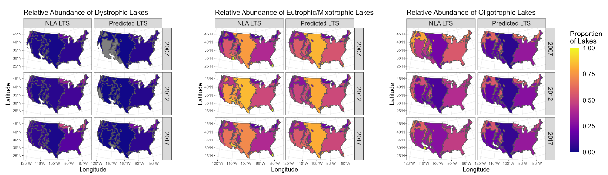
National-scale maps of U.S. Environmental Protection Agency Level I Ecoregions colored by proportion of lakes occurring in that ecoregion. For each trophic state, we compare estimated trophic state relative abundance from the NLA with predicted proportions from the ensemble LTS-US dataset.
Meyer, M., Topp, S., King, T., Ladwig, R., Pilla, R., Dugan, H., Eggleston, J., Hampton, S., Leech, D., Oleksy, I., Ross, J., Ross, M., Woolway, R. I., Yang, X., Brousil, M., Fickas, K., Padowski, J., Pollard, A., Ren, J., & Zwart, J. (2023). National-scale, remotely sensed lake trophic state, 1984-2020. California Digital Library (CDL). https://doi.org/10.31223/x59h4w.
Sources/Usage
CC BY 4.0