
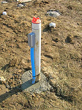
Four wells installed for use conducting borehole radar tomogragraphy

Detailed Description
Four wells were installed for use in conducting borehole radar tomography at the study area. The radar data will be used to help characterize the hydrogeology of the site and to inform analysis and interpretation of other geophysical data collected during monitoring.
Sources/Usage
Public Domain.