
Front cover of three Scientific Investigations Maps (FY 2026 Q1)
Detailed Description
Scientific Investigations Maps
The scientific investigations map series are used for scientific results of studies presented as black-and white or multicolor maps. Maps may be accompanied by companion pamphlets. These maps contain diverse subjects such as geology, bathymetry, vegetation, landforms, hydrology, land classification, map projections, distribution of species, as well as maps of the Moon, planets, and other satellites. Maps and pamphlets may include additional descriptive information and graphical presentations that are not maps, such as descriptions of map units, correlation charts, cross sections, block diagrams, tables, photographs, or other illustrations. This series may be a collection of related maps addressing different aspects of a single geographic area or scientific topic, issued separately, or as a set.
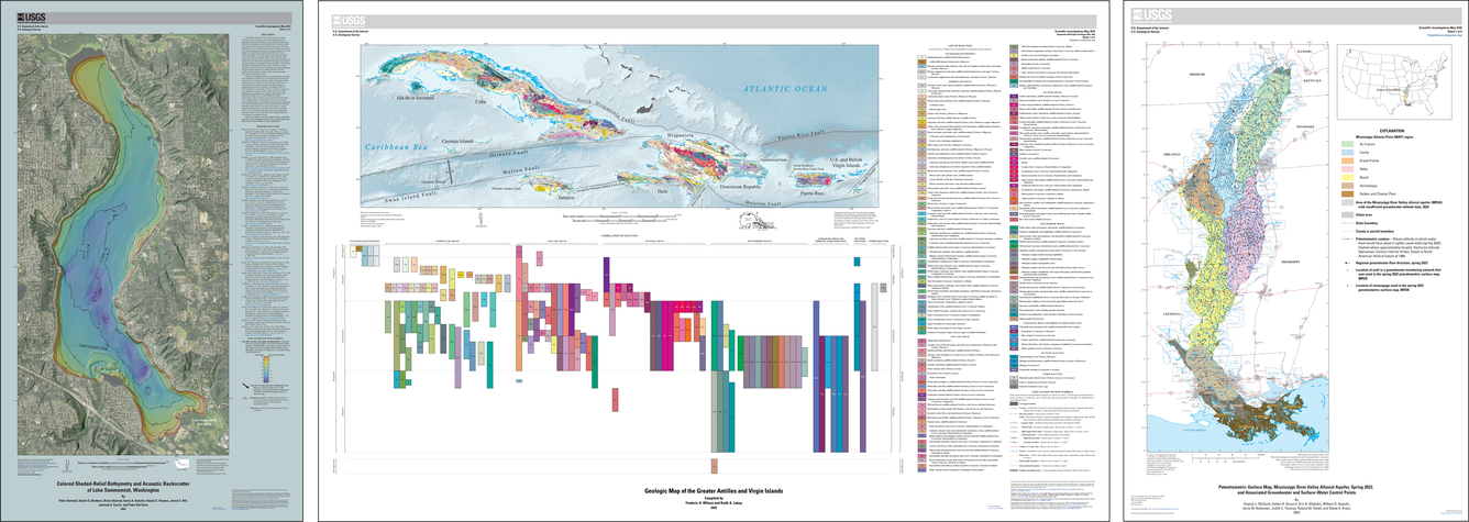
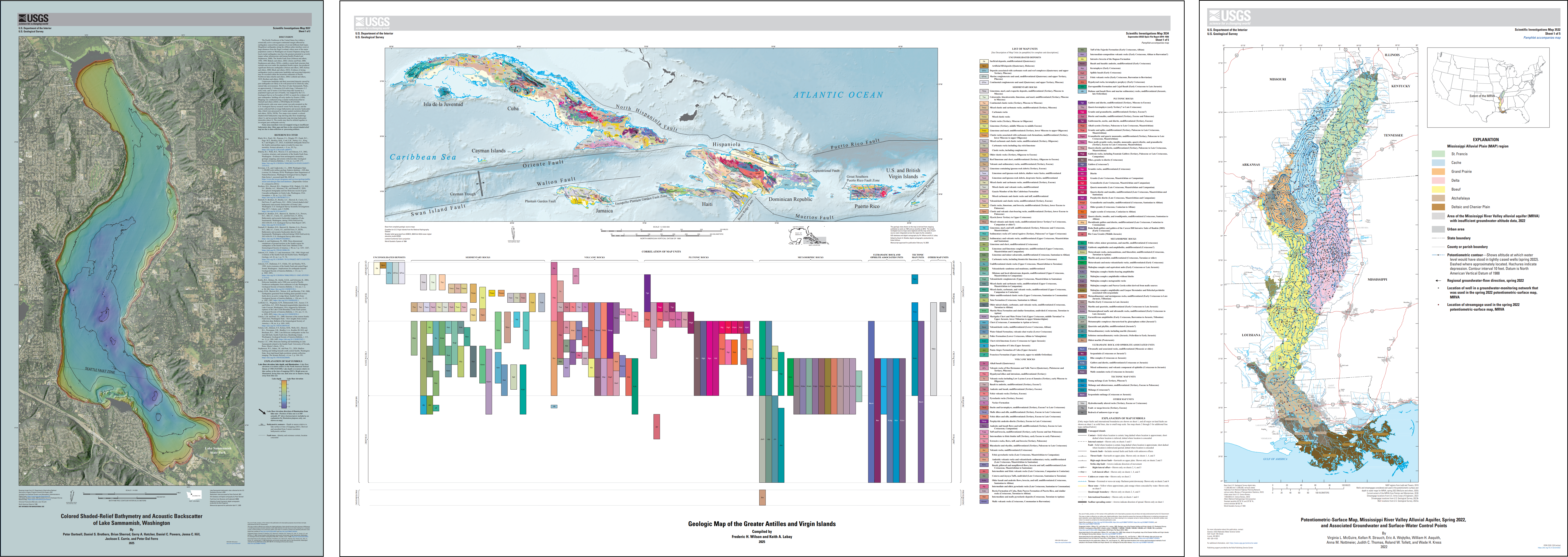
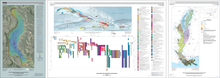
Scientific Investigations Map 3537 | Scientific Investigations Map 3534 | Scientific Investigations Map 3532
Sources/Usage
Public Domain.