
Global Positioning System - Past Year - Kīlauea
By Kīlauea
2019 (approx.)
Detailed Description
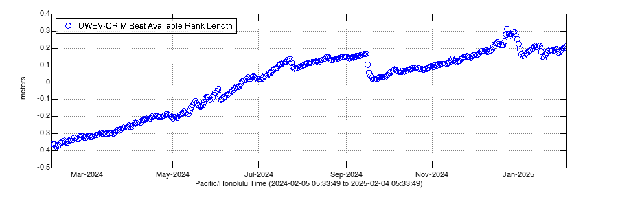
Change in distance between two Global Positioning System (GPS) stations located on opposite sides of Kīlauea's caldera. A rapid increase in distance can be interpreted as inflation of the summit magma reservoir.
Sources/Usage
Public Domain.