
Graph showing Halema‘uma‘u crater floor elevation, Kīlauea volcano - week
Detailed Description
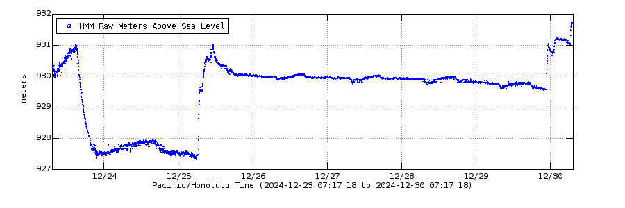
Graph showing elevation above sea level data for the past week of Halema‘uma‘u crater, at Kīlauea volcano's summit. This data is measured with a fixed laser rangefinder instrument that continuously measures the distance to a location on the western crater floor surface, and telemeters data to HVO in real time. The raw data has been edited for this graph, with a running mean average filter of 3600 seconds. Variations in plotted depth can occur due to laser rangefinder returns on gas rather than the lava surface.
For reference, the base of Halema‘uma‘u after the 2018 collapse event was equal to an elevation of 518 meters (1699) ft above sea level and the upper caldera floor is at an elevation of approximately 1075 meters (3530 ft) above sea level.
Sources/Usage
Public Domain.