
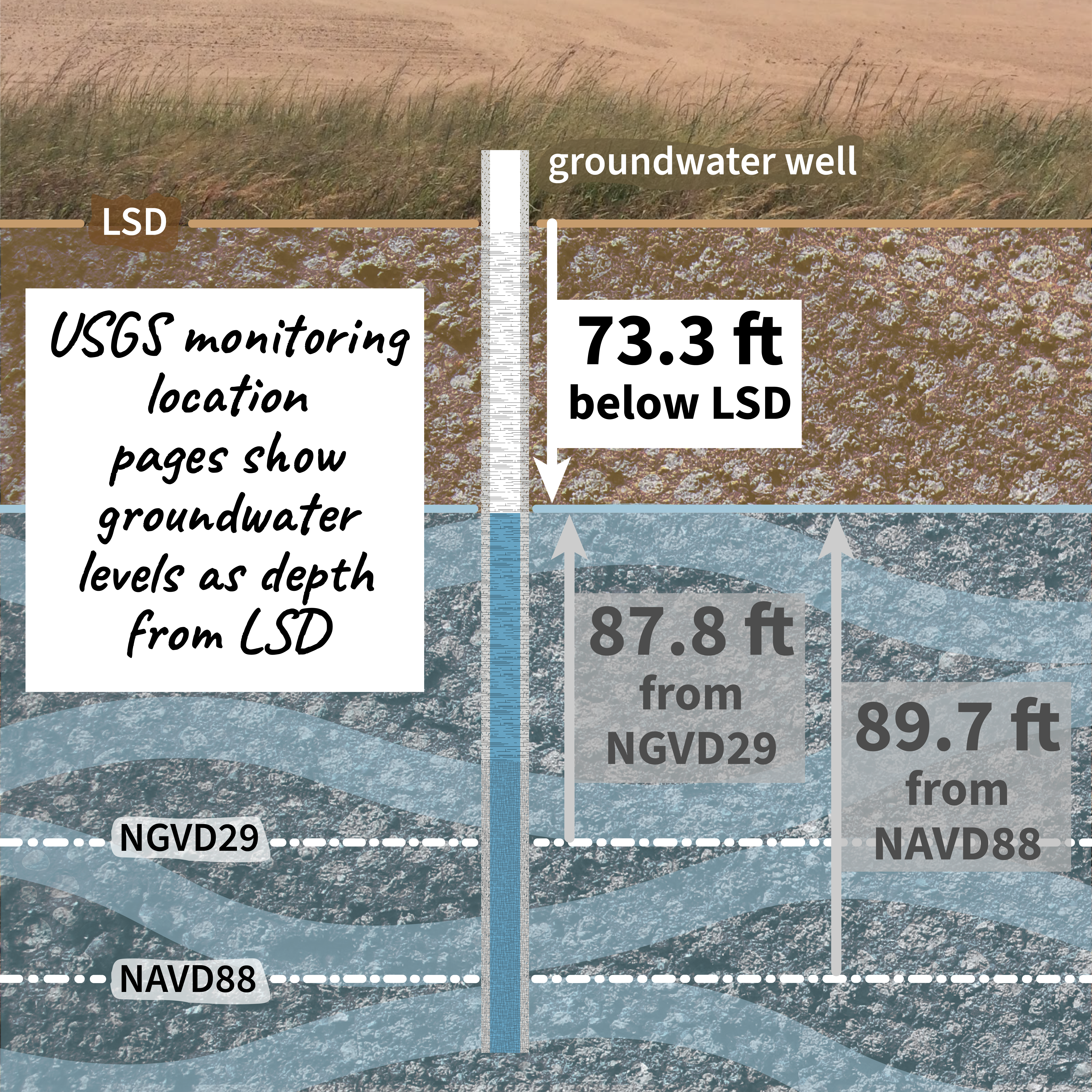
Groundwater levels as depth from land surface datum, such as 73.3 feet from land surface.

Detailed Description
USGS serves data from almost 1 million groundwater monitoring wells!
Groundwater levels can be measured from ground level (land surface datum, or LSD) or from standardized datums, such as the North American Vertical Datum of 1988 (NAVD88).
USGS monitoring location pages show groundwater levels as depth from land surface datum, such as 73.3 feet from land surface datum in this example.
Checkout current or historic groundwater levels near you with the National Ground-Water Monitoring Network.
Relationships - Complicated #30DayChartChallenge
Sources/Usage
Public Domain.