
High streamflow measured across California during New Year's storm

Detailed Description
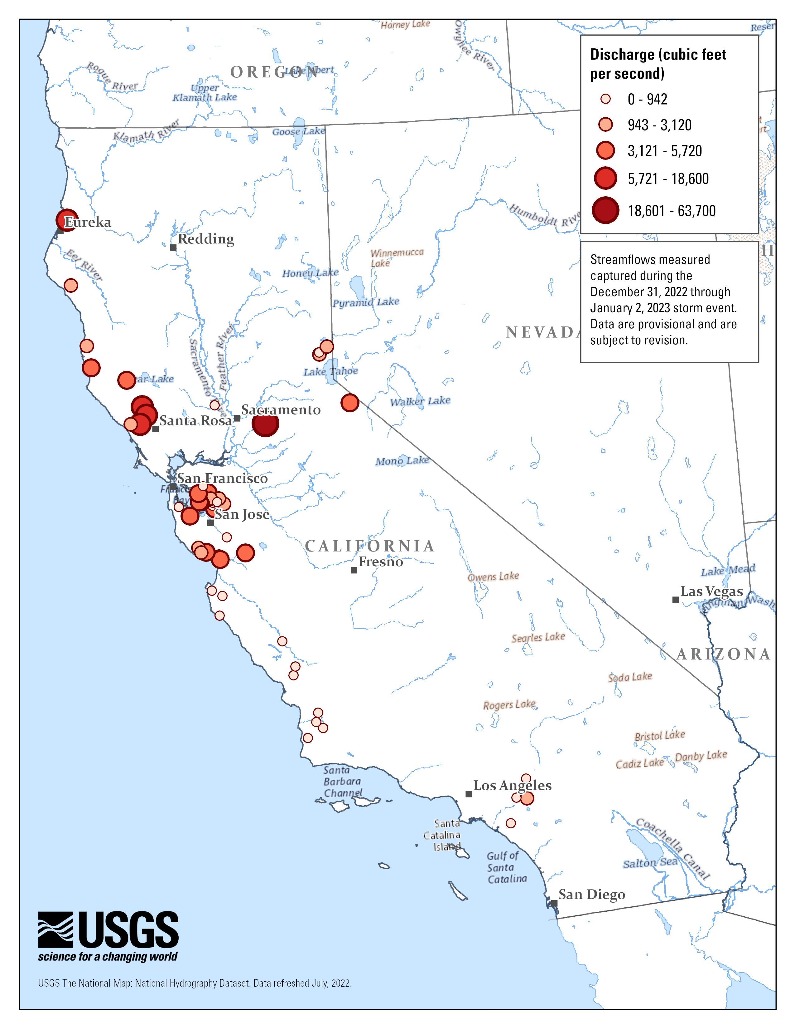
At atmospheric river brought heavy precipitation to California from December 31, 2022 through January 2, 2023. USGS crews took 77 measurements at 58 sites across the state, with northern California being hardest hit. This map shows where some of the highest streamflow occurred. Data are provisional and subject to revision.
Sources/Usage
Public Domain.