
How are lava-flow maps made during an eruption?
Detailed Description
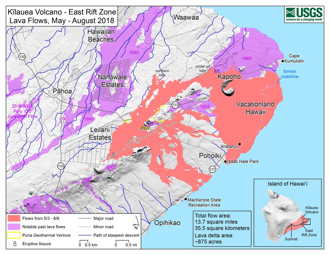
This map of Kīlauea Volcano's lower East Rift Zone, created by USGS Geographic Information Systems (GIS) analysts, shows the extent of the 2018 lava flows (pink), which covered an area of about 35.5 sq km (13.7 sq mi) and added about 875 acres of new land to East Hawai‘i. There has been no lava flow expansion since August 9, 2018. Minor activity within the fissure 8 cone continued into early September 2018 but did not expand the flow margins. Shaded purple areas depict lava flows erupted in 1840, 1955, 1960, and 2014-2015. USGS map.
Sources/Usage
Public Domain.