
Hurricane Michael Pre- and Post-Storm Photo Comparisons - CSB
Detailed Description
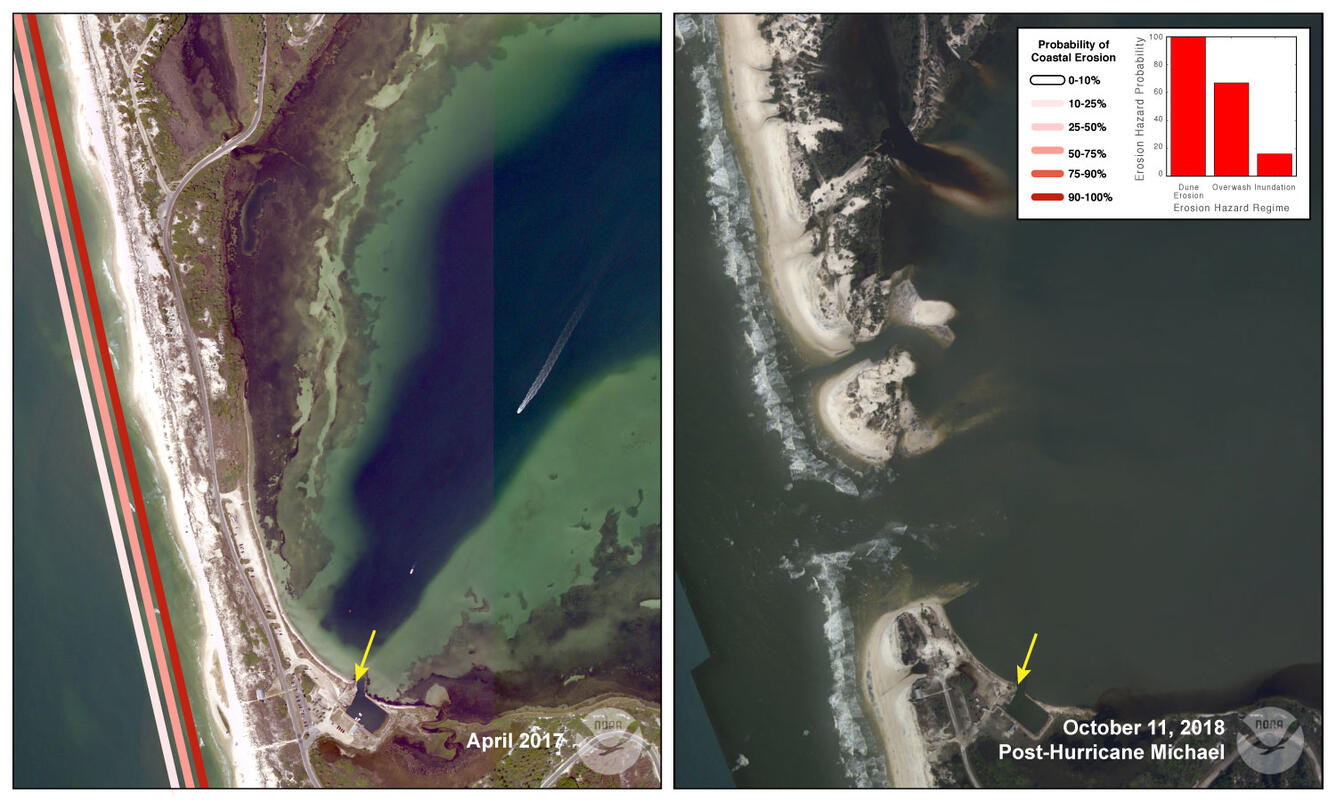
Location 7: Storm surge and waves completely eroded and breached a low, narrow spot on Cape San Blas, creating two new inlets and severing the only road access in T.H. Stone Memorial St. Joseph Peninsula State Park. The predicted probability of inundation here was only 26%, but the scale of the predictions is for 1 kilometer (0.6 mile) sections of coast, and the model likely did not resolve the low, narrow area that breached.
Sources/Usage
Public Domain.