
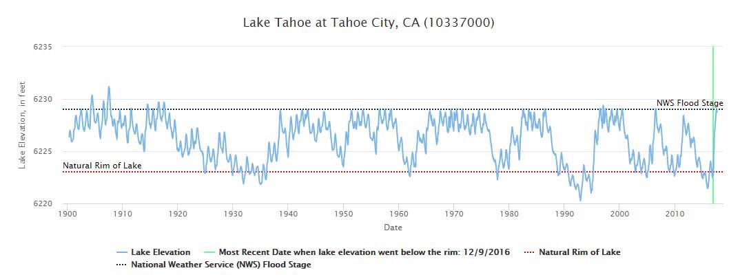
Hydrograph (historic lake elevation) of Lake Tahoe
Detailed Description
Hydrograph of Lake Tahoe elevation, in feet, as measured at USGS Station 10337000 near Tahoe City, CA. This hydrograph shows historic lake elevation levels, in feet, against the backdrop of the natural rim elevation of the lake and the National Weather Service (NWS) Flood Stage. Data before October 1957 were collected monthly; data after were collected daily.
Sources/Usage
Public Domain.