
Image of Image of benthic algae mapping.

Detailed Description
Image of benthic algae mapping.
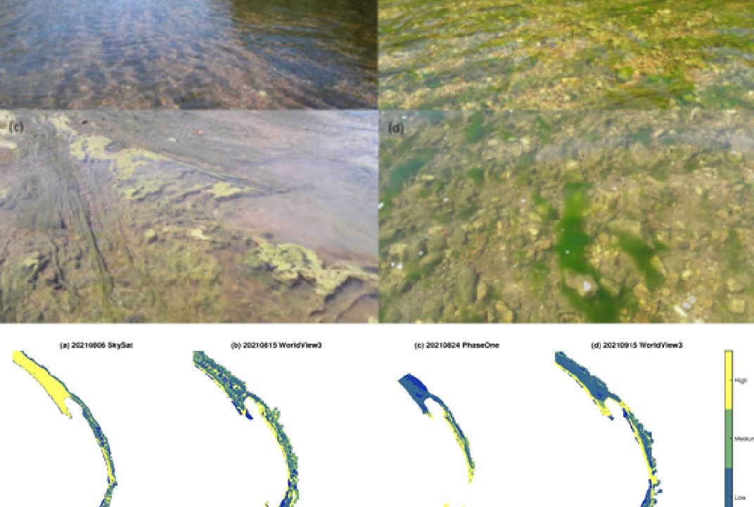
Top section of Image: Photos of benthic algae along the Gilbert reach of the Buffalo River. (a) Provides an overview looking upstream and (b–d) illustrate the diversity of algal forms present within the reach. Photographs used with permission from Derek Filipek of the US National Park Service.
Bottom of Image: Time series of algal density classification maps produced from various images of the Maumee reach of the Buffalo River.
Sources/Usage
Public Domain.