
Intertidal subclasses extracted from images
By St. Petersburg Coastal and Marine Science Center
September 2021 (approx.)
Detailed Description
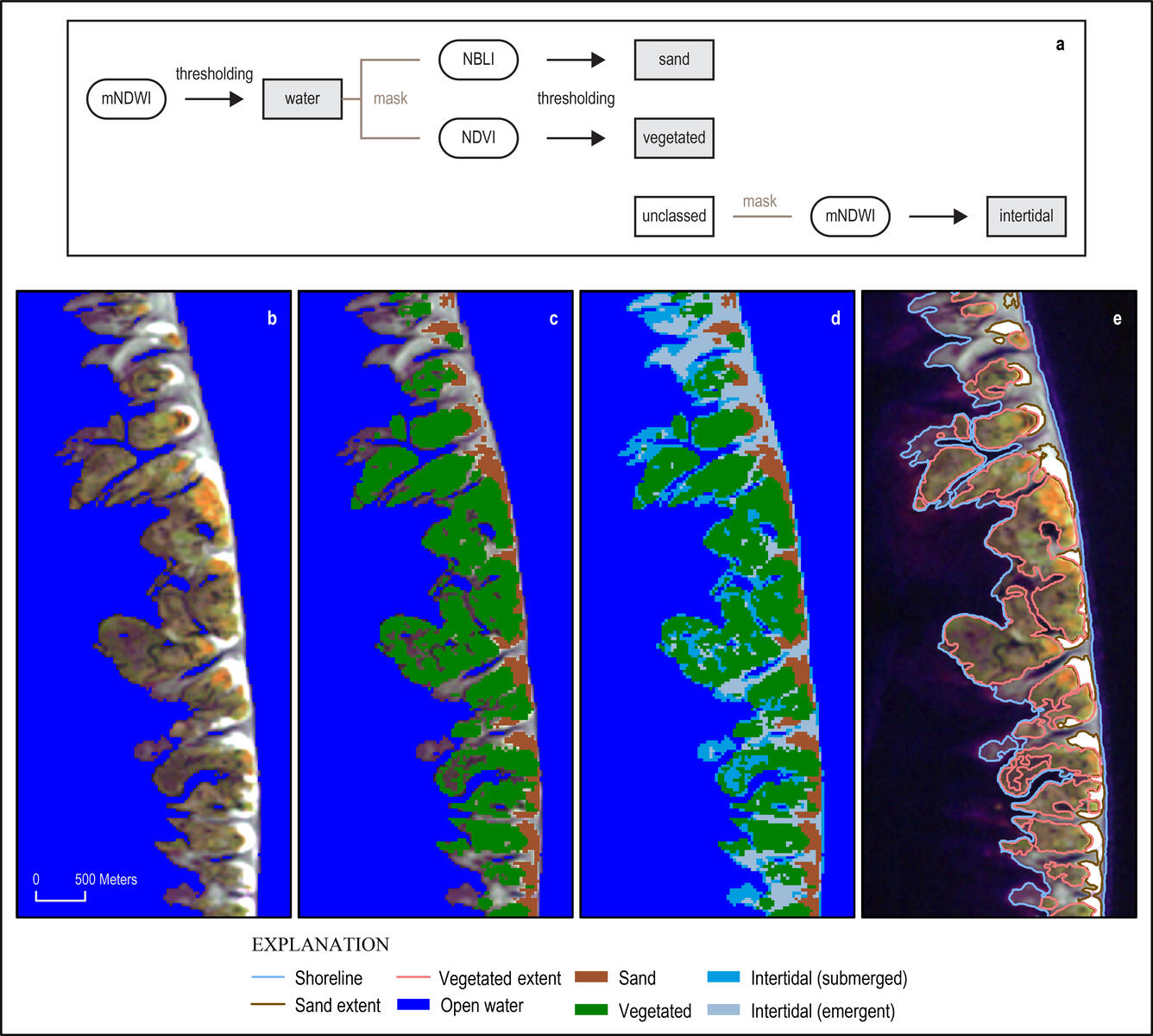
From left, normalized difference vegetation index (NDVI) spectral indices used to extract (b) water, (c) sand and vegetated, and (d) intertidal subclasses defined in this study. (e) Vector shoreline, sand, and vegetated extents were extracted by contouring the mNDWI, NBLI, and NDVI images using the calculated Otsu thresholds.
Sources/Usage
Public Domain.